Decoding Trail Markings Around the World
Every country marks its hiking trails differently. Learn to read paint blazes, cairns, scallop shells, and some of the quirkiest markers on earth.

Anja
Published March 24, 2026
Edited May 14, 2026
8 min read
Quick links
You've probably walked past hundreds of them without thinking twice.
Trail markings are everywhere. They're the silent language of the mountains, and they've been guiding hikers for over 130 years.
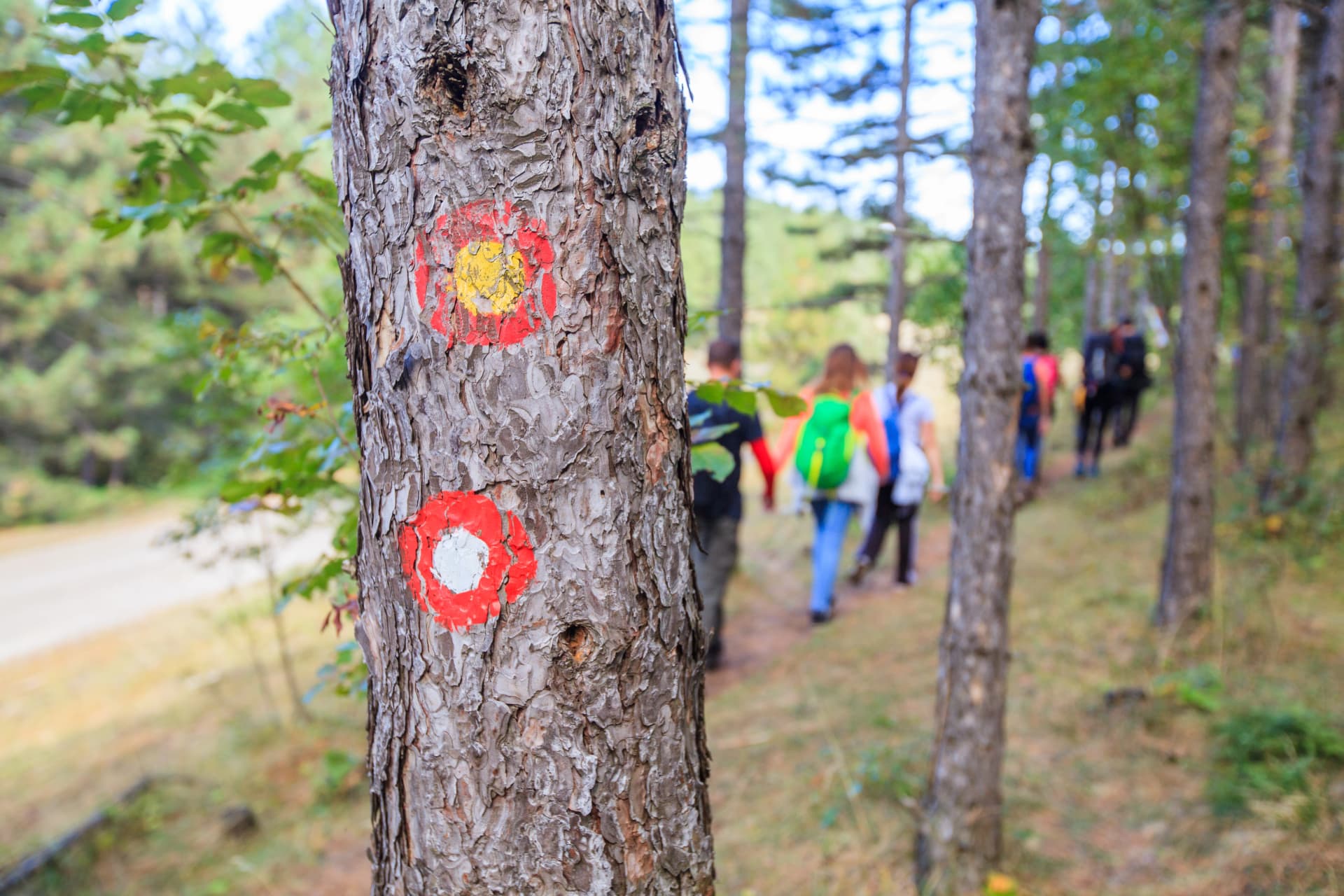
But here's the thing: every country does it differently. Hike in Slovenia and you follow a white dot inside a red ring. Cross into Italy and suddenly it's red-and-white stripes with numbers. Hop over to France and the stripes change again. Head to Scotland and… well, good luck — there's barely anything at all.
What Are Trail Markings?
Trail markings — also called blazes or waymarks — are visual cues placed along hiking routes to keep you on the right path.
They come in many forms:
paint on rocks,
stripes on trees,
stacked stones,
metal signs,
coloured ribbons,
carved symbols, and in at least one country,
seashells.
Their job is simple: tell you where to go when the trail itself isn't obvious.
Why Do Trail Markings Exist?
A well-worn path through a valley is easy to follow. But trails don't stay obvious forever. Once you climb above the treeline, cross a rocky plateau, enter dense forest, or hit a snowfield — the path can vanish completely. Trail markings pick up where the ground leaves off.
They also serve a less obvious purpose: protecting nature.
By channelling hikers along established routes, markings prevent people from trampling fragile vegetation, disturbing wildlife, or creating dozens of competing paths across a mountainside.
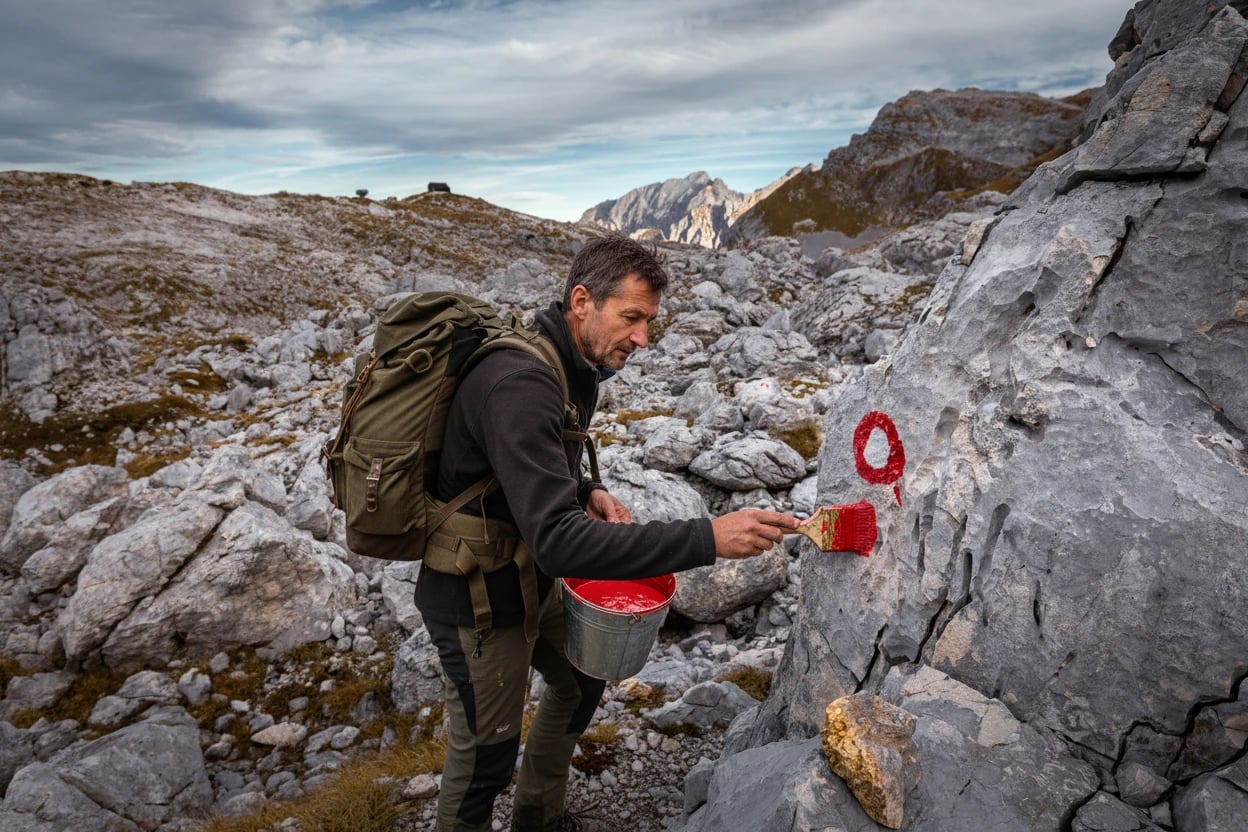
Most trail marking is done by hiking clubs and mountain associations — often by retirees and weekend volunteers who maintain thousands of kilometres of trails for free, year after year. Hikers owe these people more than they realise.
The Most Common Trail Markings You'll Find on the Trail
No matter where you hike, trail markings tend to fall into a handful of types. Here's what to look for.
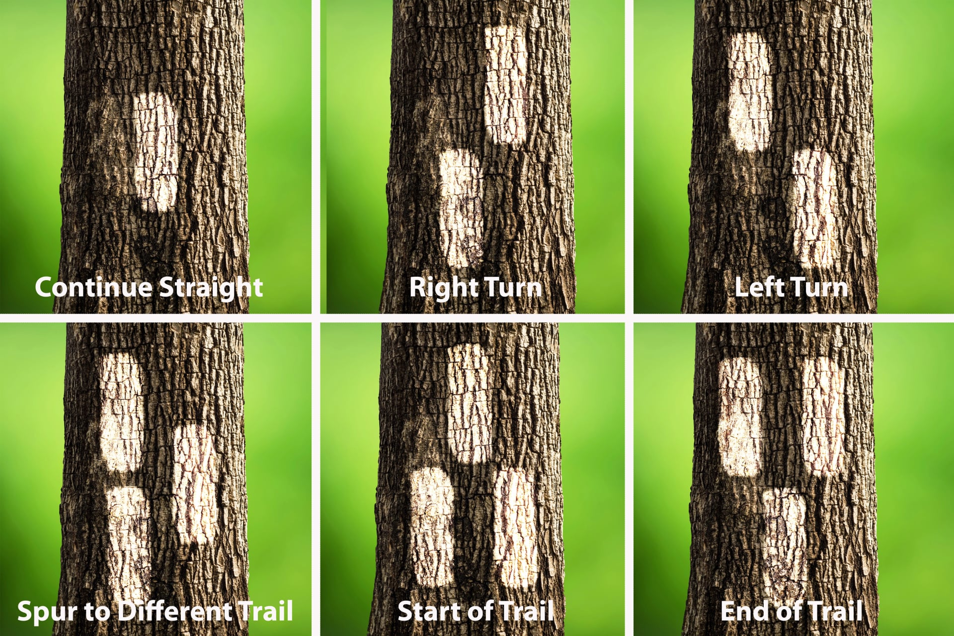
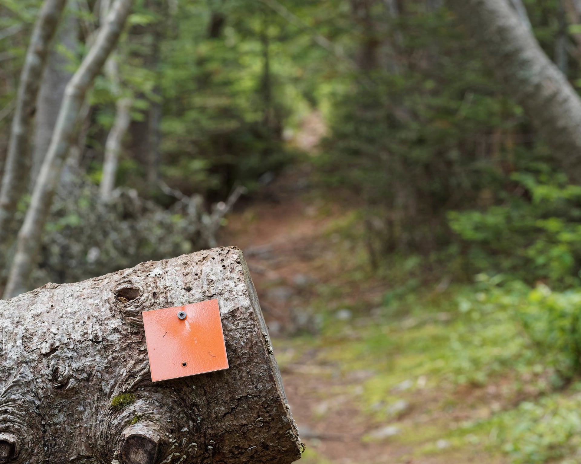
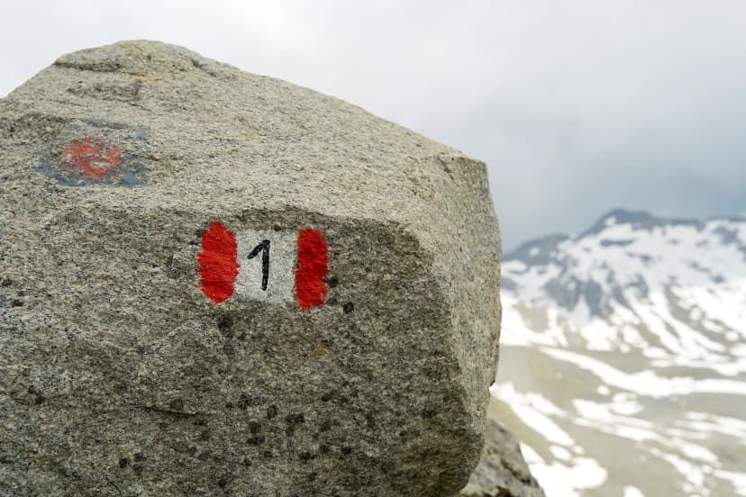
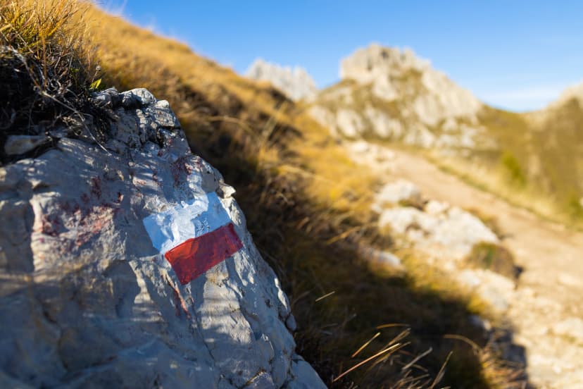
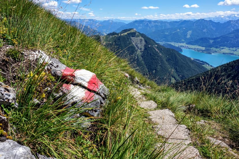
1. Paint Blazes
The most widespread trail marking method in the world. A painted symbol — a rectangle, stripe, dot, or shape — applied directly to rocks, trees, walls, or posts. Cheap, visible, and surprisingly durable.
The style changes depending on where you are:
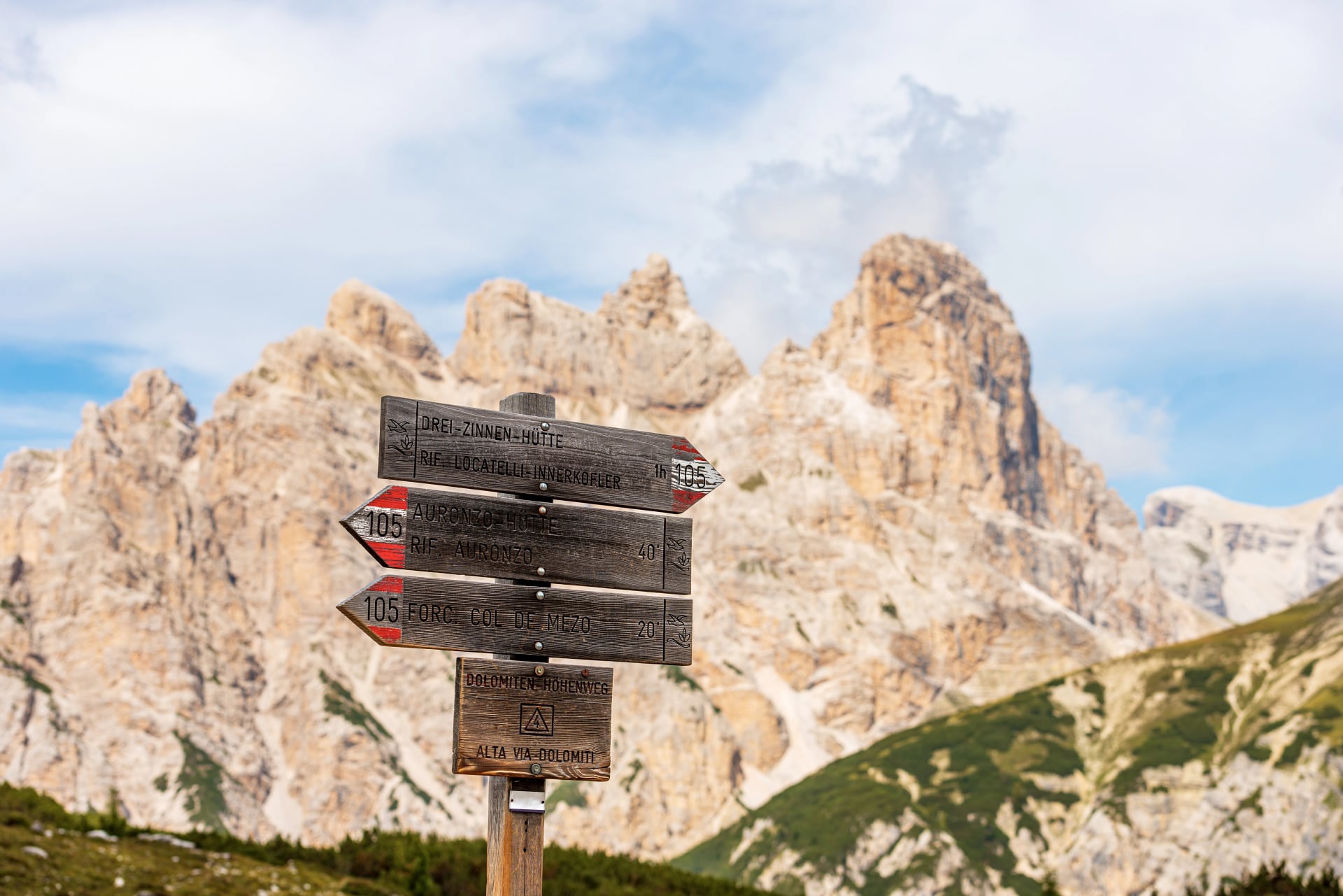
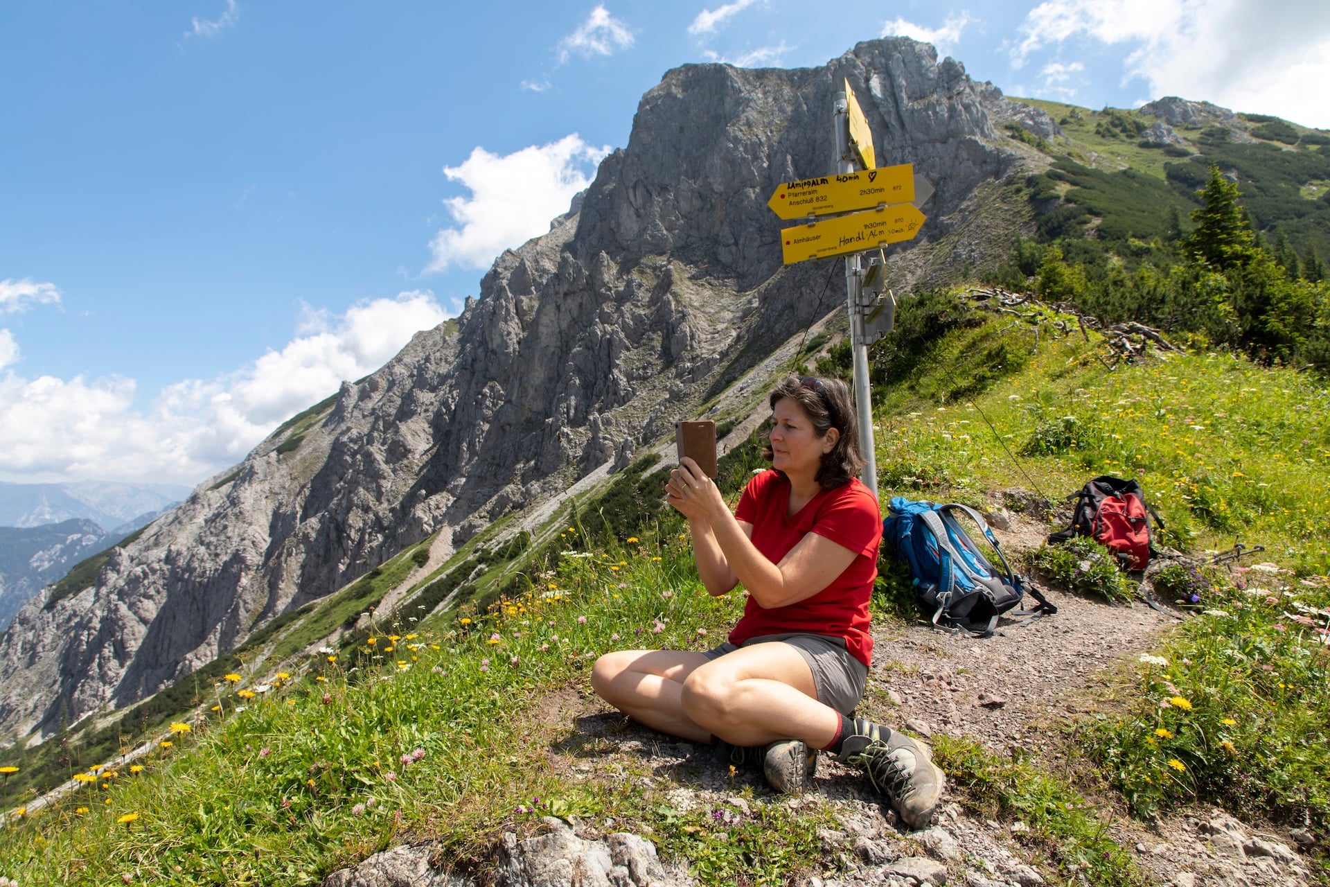
2. Signposts
More informative than paint, signposts show trail names, destinations, distances, and estimated walking times. Some countries are famous for them:
Switzerland is the gold standard. Its yellow metal signposts — with pointed ends showing direction — cover over 65,000 km of trails with almost obsessive precision. You could hike the entire country on signposts alone.
Austria, Germany, and South Tyrol also have excellent signpost networks, often including altitude and difficulty ratings.
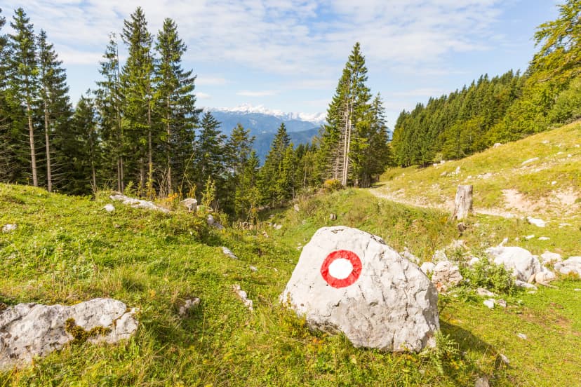
Slovenia places red signposts at trailheads and major junctions, listing destinations and approximate times alongside the Knafelc blazes.
3. Cairns (Stacked Stones)
Where there are no trees to paint and no ground to hammer posts into, hikers have stacked rocks for thousands of years. Cairns are the universal mountain marker — found everywhere from the Scottish Highlands to the Himalaya to Patagonia.
They range from small knee-high piles to towering structures several metres tall in areas with heavy fog or snow. In North America, a smaller version — just three or four stones with a pointer rock on top — is called a "duck." The "beak" shows which direction to go.
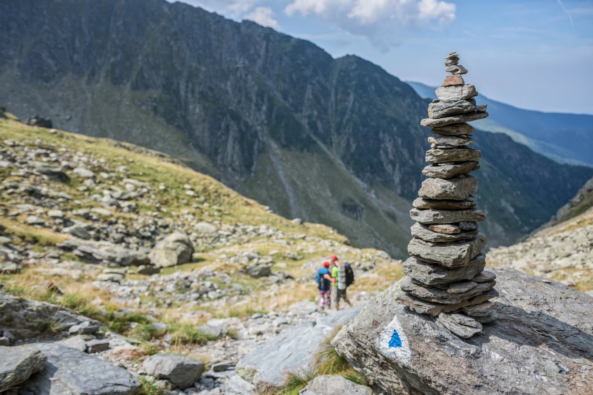
One rule: don't build your own cairns on established trails. Unofficial cairns can mislead other hikers, and moving rocks disturbs the ecosystems underneath them.
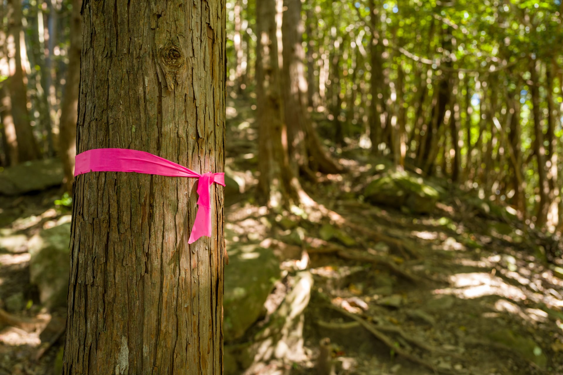
4. Ribbons and Flagging Tape
Strips of brightly coloured plastic or fabric tied to tree branches. Common in dense forests where paint blazes aren't practical, on temporary routes, or on trails under construction.
Japan relies heavily on this method — almost universally in "hot pink" — across its densely forested mountain trails. Red ribbons typically mark the ascent, yellow ribbons the descent.
5. Colour-Coded Difficulty Systems
Some countries use colour not just for trail identity but for difficulty grading:
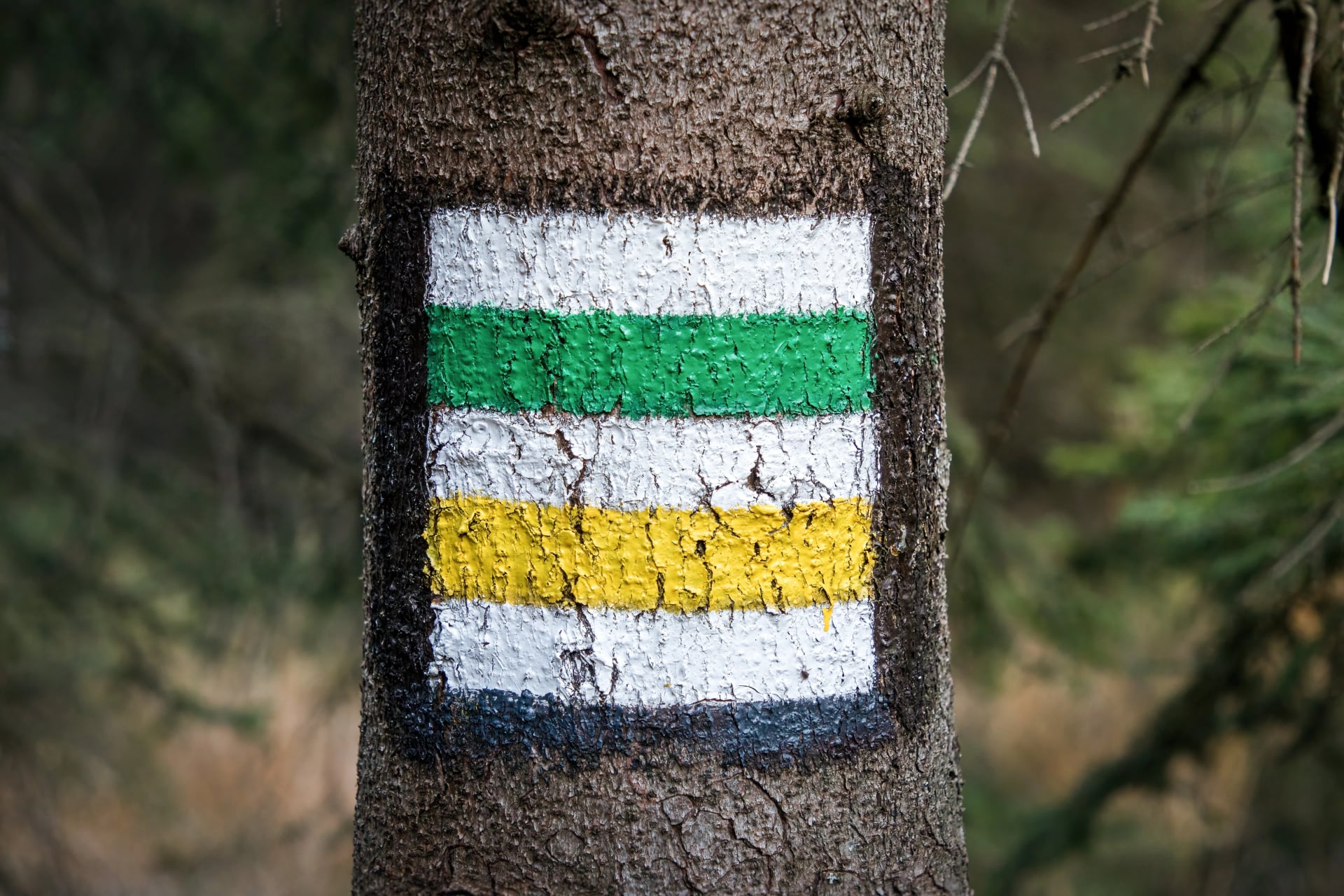
Switzerland uses yellow markers for standard hiking trails, white-red-white for mountain trails requiring sure-footedness, and white-blue-white for alpine routes needing mountaineering skills.
Norway grades trails as green (easy), blue (moderate), red (demanding), and black (expert).
If you see the colour scheme change mid-hike, pay attention — the terrain is about to get more serious.
The World's Most Unique Trail Markings
Now for the fun part. Some trail markings go far beyond paint and stone — with history, personality, and stories all their own.
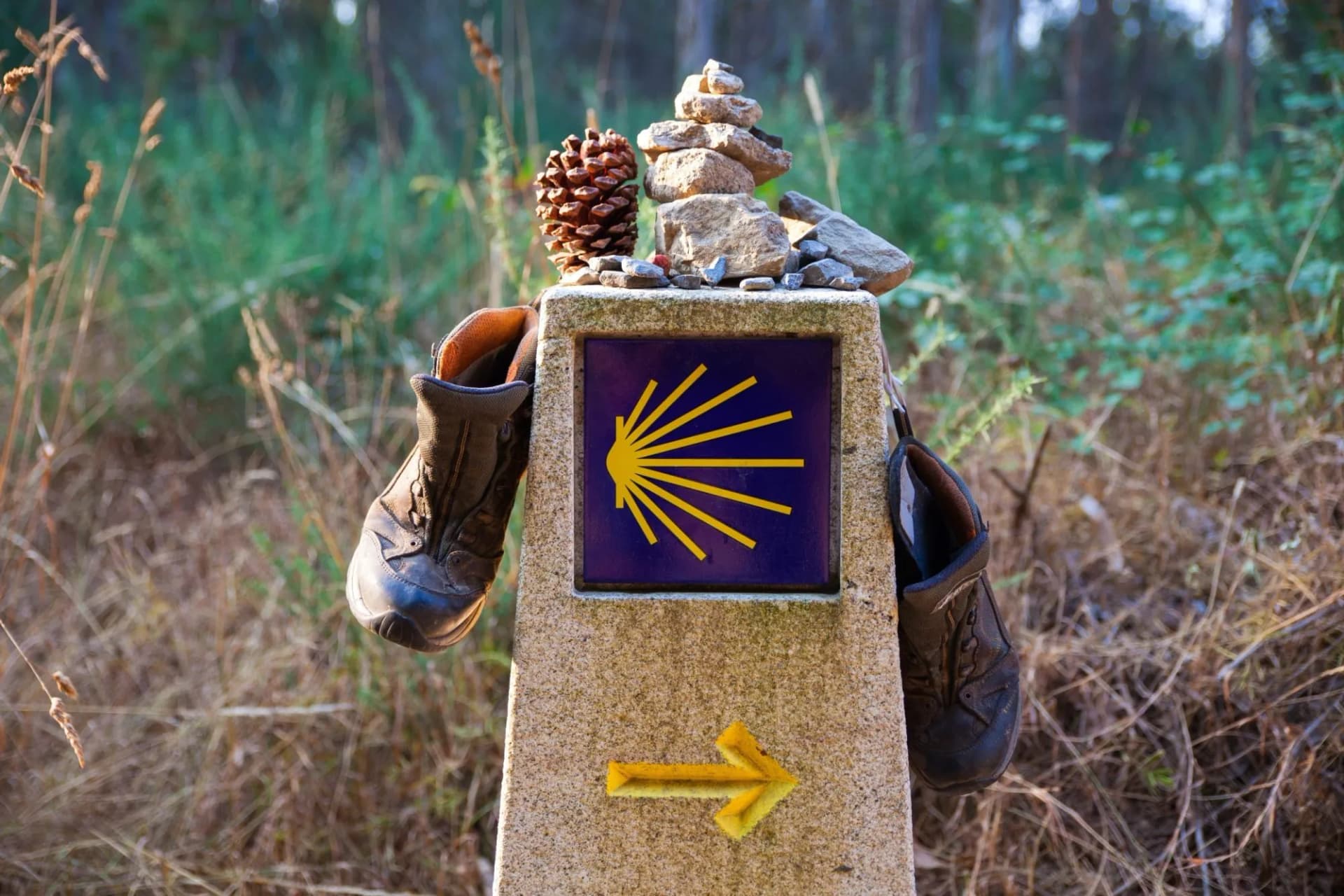
The Scallop Shells
The Camino has two iconic markers, and both have brilliant backstories.
The scallop shell has been the pilgrim's symbol since the Middle Ages. Its grooves radiate from a single point — representing the many Camino routes converging on Santiago de Compostela. But it wasn't just symbolic. Medieval pilgrims used the curved shell as a lightweight bowl — scooping water from streams and receiving food at churches along the way. The original spork.
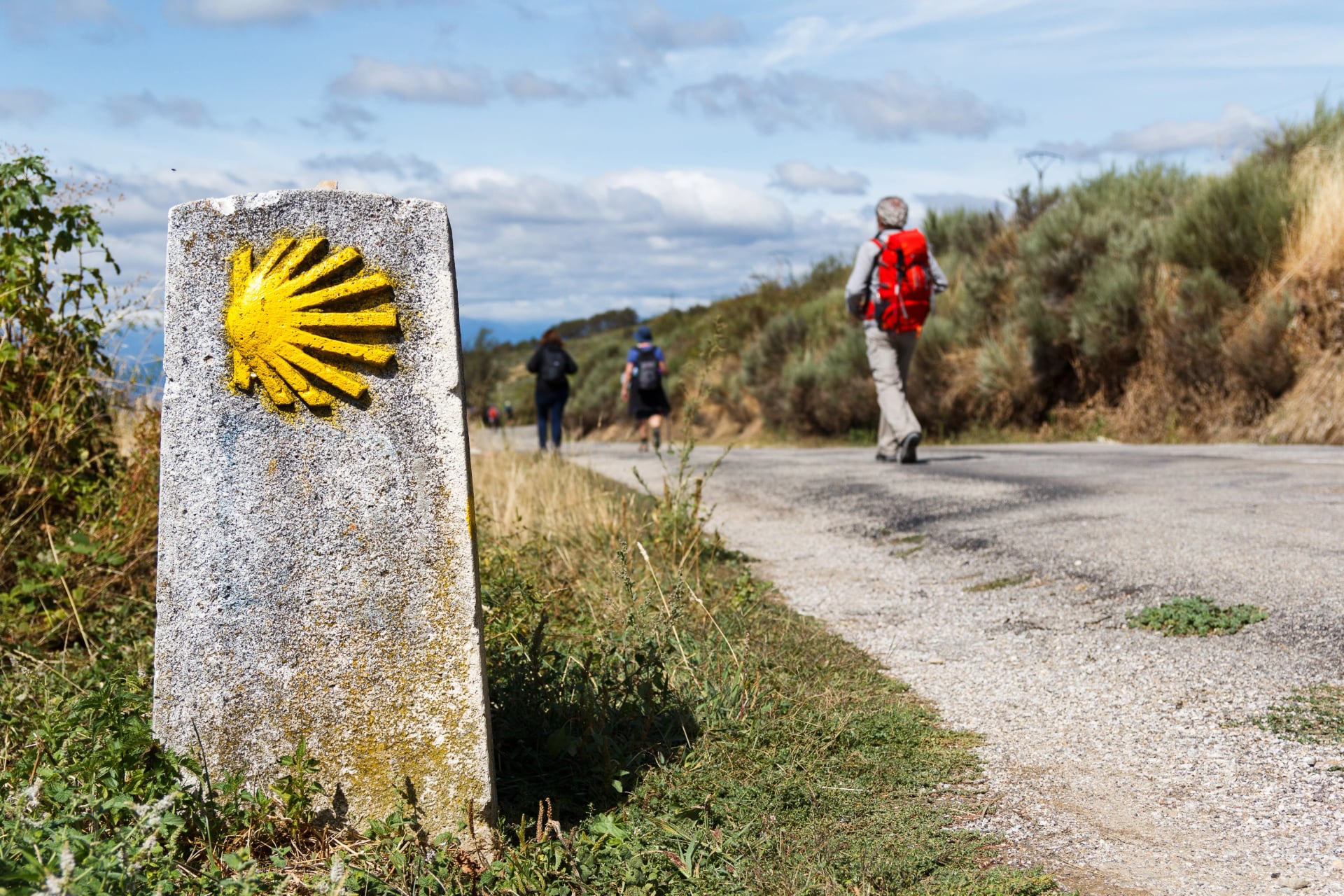
Then there's the yellow arrow. In 1984, a parish priest named Don Elías Valiña loaded his old Citroën with yellow paint and drove across northern Spain, hand-painting arrows on trees, walls, and rocks wherever the route might confuse pilgrims. His one-man mission revived the Camino Francés — and those yellow arrows are now one of the most recognised trail markers in Europe.
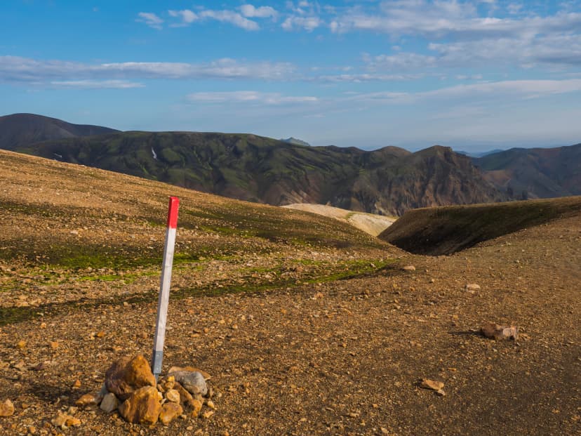
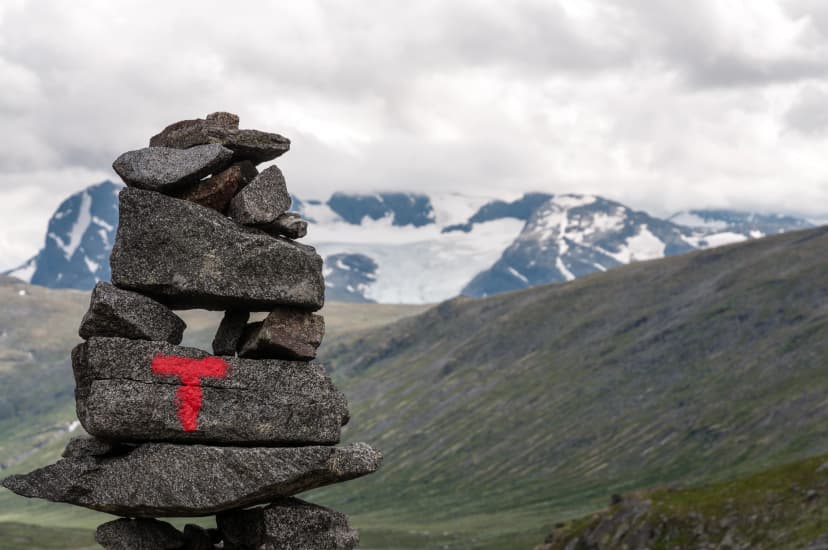
The Marking That Changes with the Seasons ❄️
Norway doesn't just mark trails — it marks them differently depending on the time of year.
Summer mountain trails get red T's on rocks.
Forest trails switch to blue stripes on trees.
And in winter, when everything gets buried under snow, the same routes are marked with birch branches or tall poles stuck into the snowpack.
Red for rock. Blue for forest. Birch for snow. Three systems in one.
Inuksuits - The Oldest Trail Markers on Earth
Long before anyone invented paint, the Inuit and other Arctic peoples were building inuksuit — stone structures used for navigation across the vast, featureless tundra. Some are shaped like humans with outstretched arms, pointing the direction of travel.
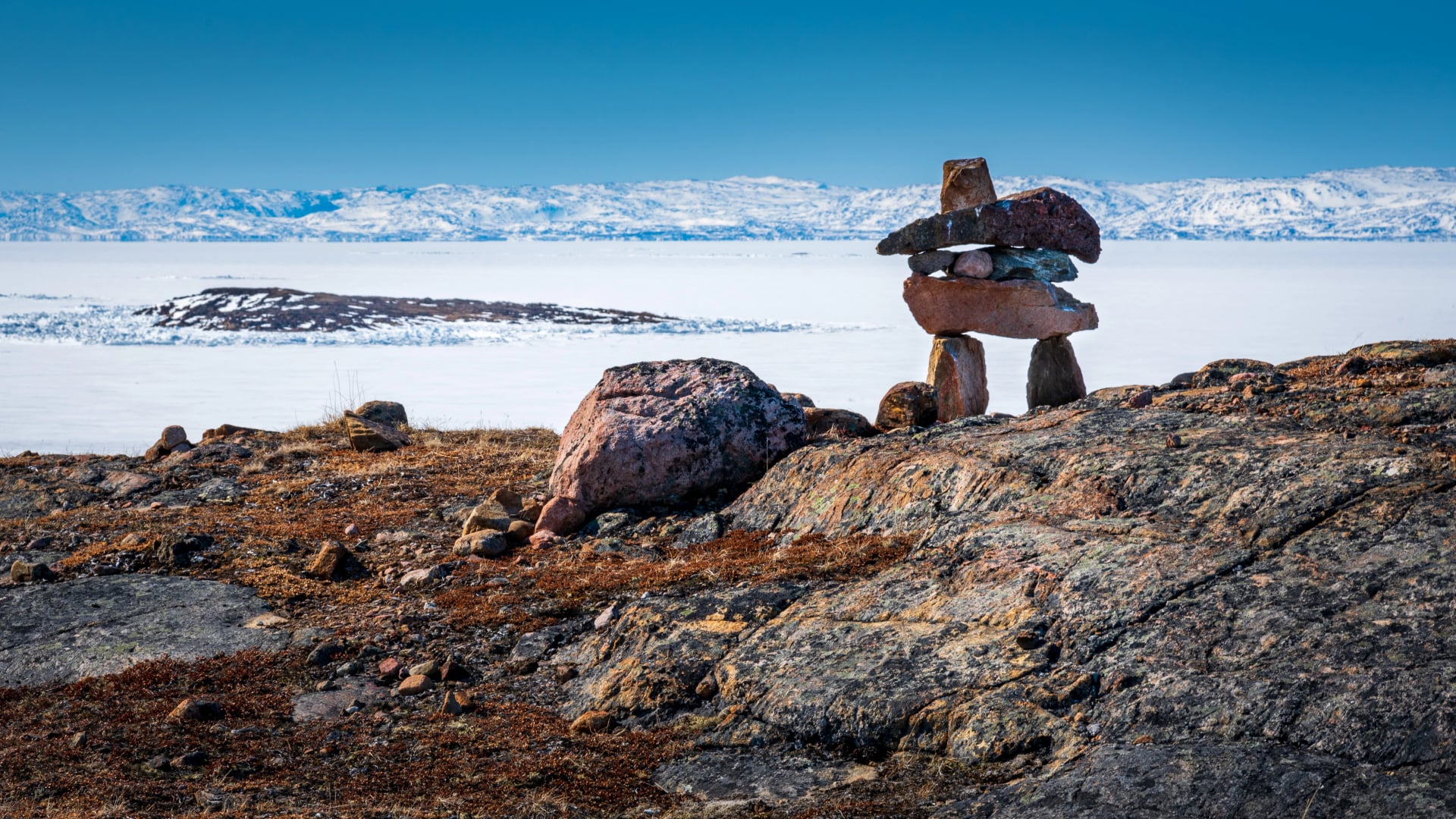
They've been guiding people for thousands of years, making them among the oldest trail markers on the planet, and you can find them along the popular Canadian trails as well.
The inuksuk is now such an important symbol that it appears on the flag of Nunavut, Canada's largest territory.
The Art of Almost Nothing
Scotland takes a proudly minimalist approach. Many Highland routes have almost no markers at all — just footprints in the mud from previous hikers and the occasional cairn.
Scotland values self-reliance and untouched wilderness. If you're heading into the Highlands, the thinking goes, you should know how to read a map. Trail markers would dilute the wildness.
For experienced hikers, it's the ultimate appeal and if you’re taking one of our Scotland hiking tours, don’t worry - the digital guidebook guides you with a detailed GPS and help you navigate. Everyone else: bring a compass. ;)
Metal Blazes on Poles
In the windswept Krkonoše mountains in the Czech Republic, conventional markings don't survive the winters. So the Czechs developed "mute blazes" — red sheet-metal cut-outs suspended on tall poles, visible to hikers in summer and skiers in winter, even in heavy snow and fog.
A niche solution for a harsh environment — and a perfect example of how trail markings evolve to match their surroundings.
Five Golden Rules (No Matter Where You Hike)
1. Learn before you go. Five minutes researching the local marking system saves hours of confusion on the trail.
2. Look behind you. Most blazes are painted for both directions. Lost the trail? Turn around — you'll probably spot a marker facing the other way.
3. Don't rely on markers alone. Even the best systems have gaps. Always carry a map.
4. When in doubt, stop. Go back to the last marker rather than pressing forward into uncertainty.
5. Never add your own. Building unofficial cairns or tying ribbons can mislead other hikers. Leave trail marking to the people who maintain them.
Remembering all of this before every trip? Not necessary.
When you book a hiking holiday with us, you receive a digital guidebook tailored to your specific trip. It covers everything you need for a comfortable and safe trek — GPS routes, accommodation details, luggage transfers, daily directions — and yes, a guide to the trail markings you'll encounter along the way.
.png&w=1920&q=85)
Browse our selection of hiking tours →
The Trail Continues
Doesn’t matter which trail marker you’ll follow, they all say the same thing:
Keep going. You're on the right path.
Next time you spot one, take a moment to appreciate the system behind it — and the volunteer who climbed that mountain with a brush so you wouldn't have to guess!
Happy trails!

About this author
Anja is our lead travel advisor and a lifelong hiker who has planned countless adventures across Europe. She prefers sunsets to sunrises — unless coffee is involved — and, ever since her first rock-climbing course, joins friends on climbing trips whenever she can.


.jpg&w=828&q=75)