The Hikers’ Guide to Spain
Learn about the five regions worth walking, when each is in season, and the July mistake that catches out first-timers.

Ajda
Published August 20, 2026
Edited August 24, 2026
14 min read
Quick links
Every June, a lot of first-time visitors book a Spanish hiking trip for August. Many arrive to find their route unwalkable — too hot, too crowded, or, in the case of the high Pyrenees, still under late-season snow. Planning matters more for hiking in Spain than for most European destinations, because the country's hiking regions have almost nothing in common: the alpine Pyrenees, the pilgrim Camino, the Moorish south, Mediterranean Mallorca, and the Atlantic Basque coast each run on their own calendar and their own type of terrain.
The regions below are the ones worth planning around. Read the piece as a filter, not a ranking — the right Spanish walking trip depends entirely on which region matches the calendar you're working with, and the dates dictate the answer more than any list of "best hikes" can.
In short:
What you get: anything from alpine ridge walking at 2,500 m to flat pilgrim roads at sea level
How hard: varies wildly by region — the Camino is easy, the Pyrenees are serious mountain terrain
When to go: March–May and September–October are the two windows that work across most of the country
Key regions: Pyrenees, Picos de Europa, Camino de Santiago, Andalusia, Mallorca
At a Glance: Five Hiking Genres
The Pyrenees — Alpine peaks, refugios, granite ridges on the French border. Best window: July to September.
Picos de Europa — Limestone drama in Green Spain, three days from Bilbao. Best window: May to October.
The Camino de Santiago — A network of pilgrim roads through northern Spain, with three practical routes to pick from. Best window: April to June, September to October.
Andalusia and the South — White villages, cork oak forests, and the country's highest peninsular peak. Best window: March to May, October to November.
Mallorca and the Coast — Mediterranean karst, dry-stone terraces, and the Costa Brava's coastal cliffs. Best window: March to May, October to November.
The Pyrenees
Style: hut-to-hut on marked mountain trails, staffed refugios above 2,000 m
Scenery: granite ridges, glacial lakes, and peaks over 3,000 m
Best for: hikers ready for real elevation and full days on rocky ground
Best window: late June to mid-September
While there: Catalan mountain cooking (escudella, botifarra), and the Aran Valley villages that speak their own Occitan dialect
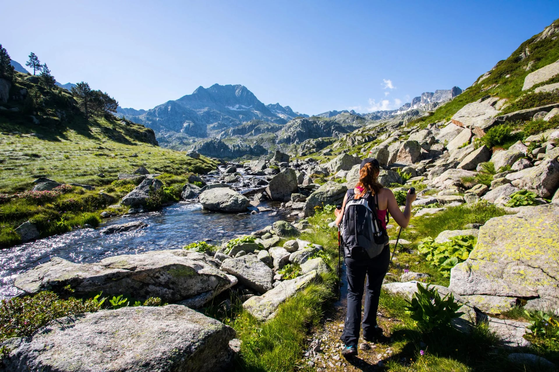
The Spanish Pyrenees are the only place in the country where "alpine" is not a stretch. The range runs 435 km along the French border, with peaks above 3,000 m and a network of high refugios that makes hut-to-hut walking a real option. The signature long-distance route is the GR11 (Senda Pirenaica), which covers 840 km from the Mediterranean to the Atlantic across roughly 39,000 m of cumulative ascent — around 44 days for a fit walker.
Most visitors don't have that time. The way to see the range in a week is to pick one of the two great national parks and walk a loop inside it. Aiguestortes i Estany de Sant Maurici in the Catalan Pyrenees has a purpose-built circuit called the Carros de Foc — nine refugios linked by a signposted route through granite lake basins, and the closest thing Spain has to the Tour du Mont Blanc at a fraction of the traffic. Ordesa y Monte Perdido in Aragón is the alternative: a UNESCO-listed limestone amphitheatre with the country's most photographed cirque.
Season is narrow. The passes don't clear properly until late June, and start closing again by mid-September. This is one of the few Spanish regions where high summer is the right time to go — the opposite of the country's coastal and southern trails.
For a week-long alpine trip in Spain, the Carros de Foc is the most efficient way in: a self-contained loop with the huts booked, the passes marked, and no logistics between stages.
For the classic long-distance line across the Aragón side of the range, our GR11 Highlights hike covers the most scenic stretch without asking you to commit to the full 840 km.
Picos de Europa
Style: short valley days combined with one or two nights at a high refugio
Scenery: limestone gorges, cloud-catching valleys, and the 500-metre orange tower of Naranjo de Bulnes
Best for: hikers who want alpine drama on a compact time budget
Best window: late May to early October
While there: Cabrales blue cheese, Asturian sidra poured from arm's length overhead, and coastal detours to Llanes and Cudillero
Two hours west of Bilbao airport, the Picos de Europa rise abruptly out of the Cantabrian coast — a compact limestone massif that packs Europe-scale mountain walking into a range only 40 km wide. The iconic peak is Naranjo de Bulnes (Picu Urriellu, 2,519 m), a sheer orange tower that draws climbers from across the continent. The iconic walk is the Ruta del Cares, a 12 km trail carved into the cliff face of the Cares Gorge, following the river 300 m below through tunnels, bridges and rock-cut ledges.
The Picos are wetter than the rest of Spain. This is Green Spain, the north-facing Cantabrian belt that catches Atlantic weather and stays green all summer while Castilla burns brown. Expect damp mornings, forest air, and a real chance of cloud on the tops even in August. While Andalusia hits 40°C in July, the Picos rarely go past 25°C at valley level.
Two nights in a high refugio — Refugio de Urriellu at 2,200 m or Refugio Vega de Ario — turn a Cares day walk into a proper mountain trip. Espinama and Poncebos are the usual base villages, both reachable by direct bus from Santander airport.
For a first Picos experience with the huts and transfers handled, our four-day loop combines a valley approach, a night at altitude, and the Cares Gorge on the final day.
The Camino de Santiago
Style: long low-elevation days on waymarked paths, staying in albergues or small country hotels
Scenery: Meseta wheatfields, Galician oak forest, or Cantabrian cliff paths depending on the route
Best for: slow walkers, first-time long-distance hikers, and anyone drawn to the pilgrim tradition
Best window: April to June, and September to October
While there: pulpo a la gallega in Galicia, Rioja wines through Navarra, and the cathedral square in Santiago at sunset
The Camino de Santiago is not one route but a network of medieval pilgrim roads converging on Santiago de Compostela in the north-western corner of Spain. Roughly 450,000 pilgrims complete a Camino each year, and the choice of route matters more than most first-timers realise. Three routes carry the vast majority of walkers.
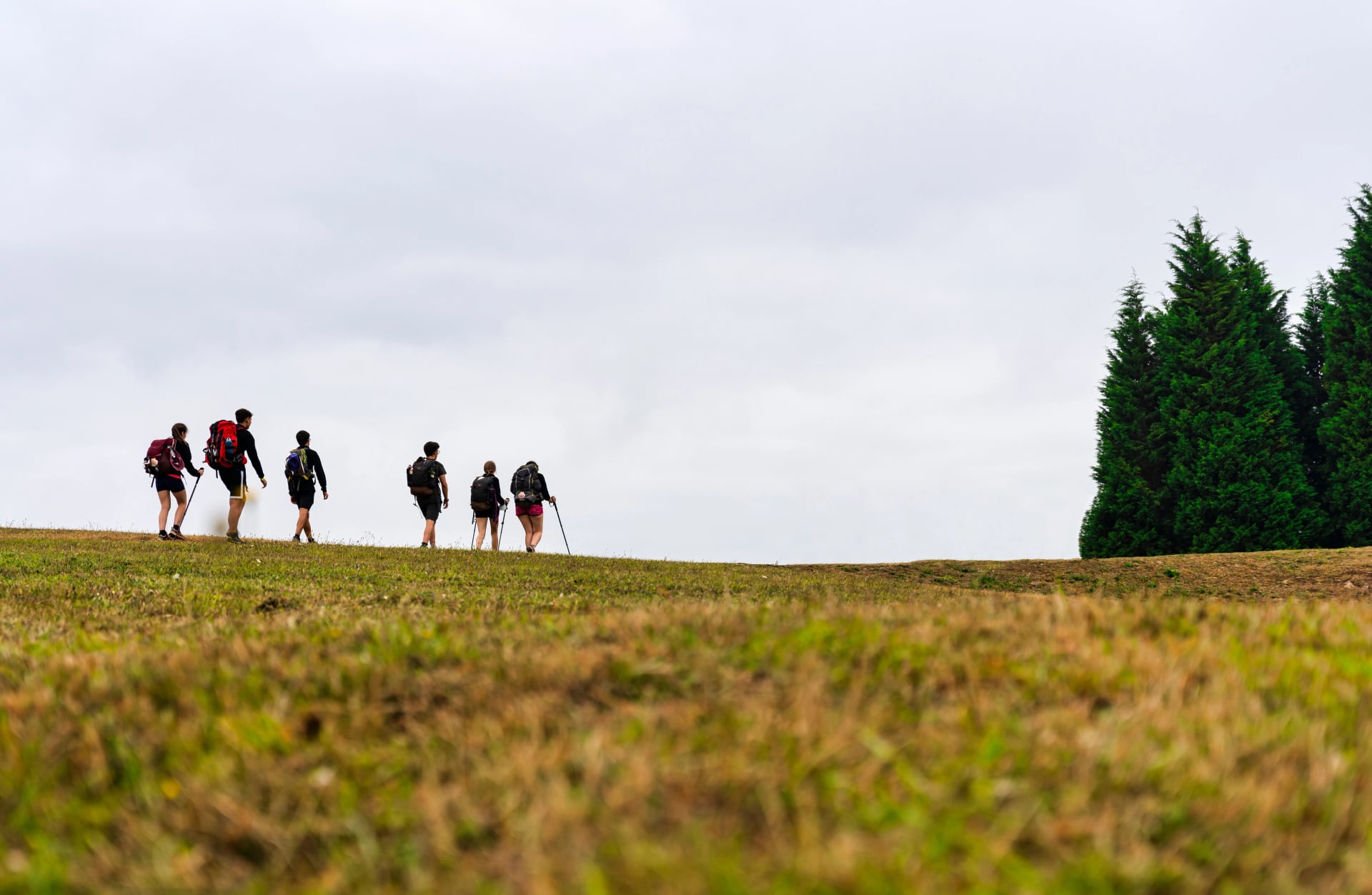
The Camino Francés is the classic — the 800 km line from Saint-Jean-Pied-de-Port across the Meseta to Santiago. It's the busiest by a wide margin (about 40 percent of all pilgrims walk some portion), the best-supported, and the most sociable. The Camino Portugués heads north from Lisbon or Porto through wine country and eucalyptus forest, with far fewer walkers and a gentler daily profile. The Camino del Norte hugs the Cantabrian coast from Irún before turning inland: cliff paths, real daily ascent, and short but hard climbs into the Basque hills — the toughest and quietest of the three.
Most first-timers on a tight schedule walk the final 100 km from Sarria to Santiago — the minimum distance that qualifies for the Compostela certificate. It takes five to seven days through Galician oak forest and delivers the emotional arrival at the cathedral. For quieter days, the Portuguese route from Vigo covers the same final week from the south with a fraction of the crowds.
For the classic finish, the Sarria to Santiago walk is our most-booked Camino trip:
For a Portuguese alternative with lighter foot traffic and coastal walking at the start, we run the same style of trip from Vigo:
For the toughest and quietest of the three — the Camino del Norte's Basque coastal week — our San Sebastián to Bilbao walk covers the pintxos, flysch cliffs and beaches of the Basque country in eight days.
Andalusia and the South
Style: inn-to-inn walks between whitewashed villages, moderate daily distances
Scenery: hilltop pueblos blancos, cork oak dehesa, limestone sierras, and Sierra Nevada's 3,000 m peaks
Best for: shoulder-season travellers, foodies, and culture-first hikers
Best window: March to May, and October to November
While there: jamón ibérico from the Sierra de Aracena, the Alhambra in Granada, and sherry from the Jerez triangle
Southern Spain runs on an entirely different calendar from the rest of the country. Andalusia in high summer is a hostile hiking environment — temperatures push past 40°C, and water sources are unreliable enough that even locals stop walking. In the shoulder seasons, though, it delivers some of the most distinctive walking anywhere in the country: Pueblos Blancos (the White Villages) draped across limestone hillsides, cork oak forests full of Iberian pigs, and Roman roads still in use as trails.
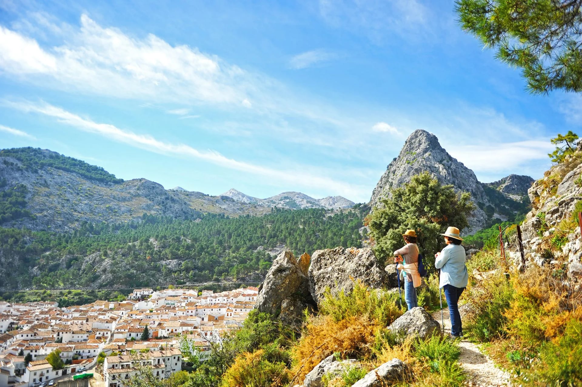
The signature walking sits in three sub-regions. The Pueblos Blancos route in Cádiz province connects Grazalema, Zahara de la Sierra and Setenil de las Bodegas across two or three days of manageable ridge walking. The Sierra de Aracena in Huelva is quieter and lower — inn-to-inn through pig-farming country famous for jamón ibérico and Moorish castles. And the Sierra Nevada rises above Granada to the mainland's highest point: Mulhacén at 3,479 m, walkable as a two-day summit from the Alpujarras.
The Andalusia rule is short: don't walk between mid-June and mid-September. April and October are the right windows. Even Sierra Nevada, which stays cool above 2,500 m, becomes a logistical problem in summer because the foothills you approach through are dangerously hot before 10 am.
For a week among the White Villages with the transfers arranged and the local ventas pre-booked, the Pueblos Blancos walk is the established route:
For a quieter alternative in the Huelva sierras with more forest and less altitude, our Sierra de Aracena walking holidays run through the same shoulder seasons at an easier pace.
The Mediterranean and the Islands
Style: village-to-village on old mule paths and coastal trails, mix of refugis and small hotels
Scenery: dry-stone terraces above the Mediterranean, olive groves, and cliff paths along the coast
Best for: hikers who want cultural walking with the option to swim at the end of the day
Best window: April to May, and October to early November
While there: pa amb oli and Sóller oranges in Mallorca, Priorat wines in the Catalan interior, and the Greek and Roman ruins at Empúries
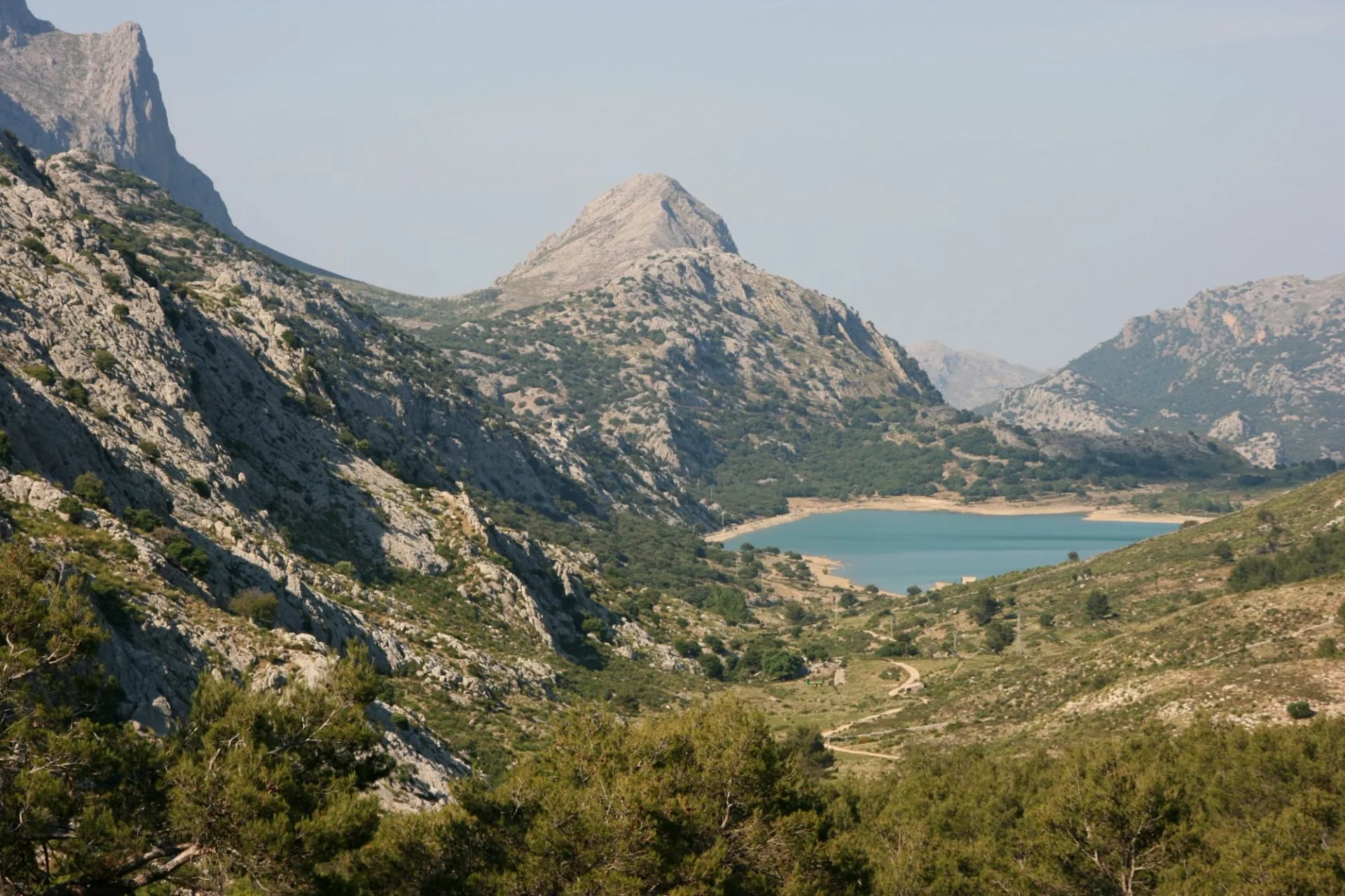
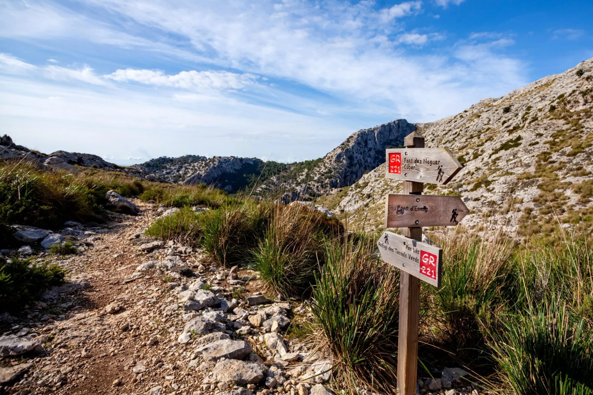
Two coastal regions handle everything Mediterranean about hiking in Spain. The first is Mallorca, where the Serra de Tramuntana — a UNESCO cultural landscape running the length of the north-west coast — carries the GR221 Dry Stone Route (Ruta de Pedra en Sec), named for the centuries-old terraces and mule paths the trail follows. Roughly 140 km over eight to ten stages from Port d'Andratx to Pollença, with restored mountain refuges plus small hotels in villages like Deià and Sóller.
The second is the Costa Brava on the Catalan coast, where the Camí de Ronda traces the cliff line north from Blanes to the French border. Once a smugglers' path, it now runs between fishing villages, cove beaches, and the Roman ruins at Empúries — rarely more than 100 m from the sea.
Both are shoulder-season walks. April to May and October to early November are the working windows: warm enough for the sea, cool enough for the terraces, and outside the July and August tourist peaks.
For Mallorca's full length with the refugis and coastal hotels sorted, the Tramuntana Trails walk covers the classic eight-day itinerary:
For a Catalan coastal alternative between cove villages and Roman ruins, our Camí de Ronda walk covers the best stretches of the Costa Brava at an easier pace.
When to Walk in Spain
Spain is one of the few European hiking countries where the standard "May to October" answer is wrong. Green Spain and the Pyrenees peak in summer, while everything else peaks in the shoulder seasons and shuts down in July and August. Four windows are worth planning around.
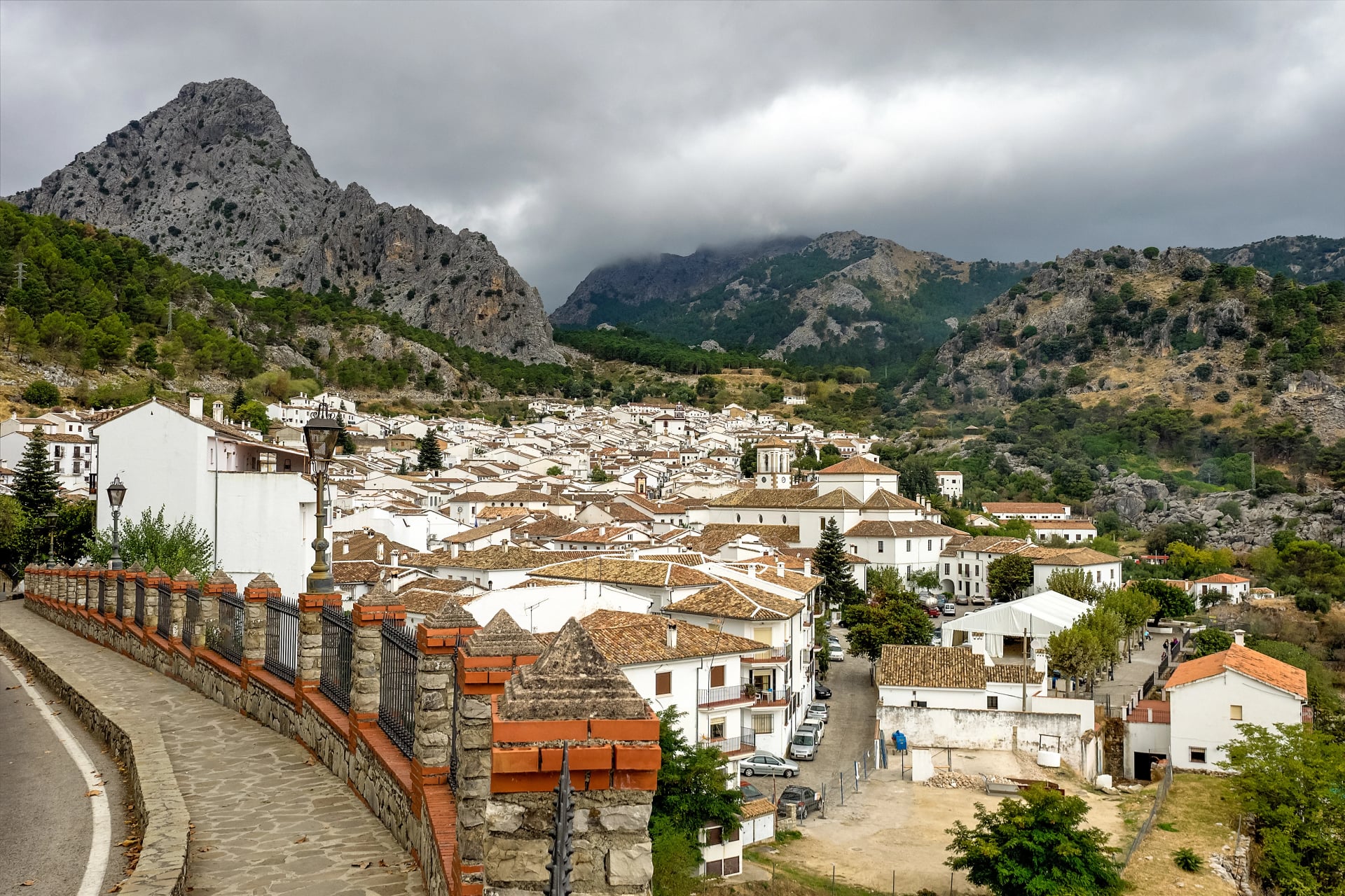
Green pasture and holm oak in the Sierra de Grazalema, at its best while the Pyrenees still hold snow
The country's largest hiking window opens in the south and works its way north. Andalusia and Mallorca are at their best from mid-March through May, with wildflowers on the terraces and temperatures in the low twenties. The coastal Camino routes (Portugués, Norte) become comfortable from April.
The Pyrenees still hold snow above 2,000 m through May. Picos de Europa is walkable at valley level but not yet for the high refugios.
Green pasture and holm oak in the Sierra de Grazalema, at its best while the Pyrenees still hold snow
Mist still in the Galician valleys at dawn: June is the one month when nearly every Spanish region is open
The best all-round month in the country. Long days, the Camino at full swing, and Picos and Sierra Nevada opening properly for summer. Andalusia is starting to get hot but stays walkable if you're on the trail by 8 am.
June is also when the Pyrenees passes open — third or fourth week, depending on the winter. Refugios in Aiguestortes and Ordesa staff up from mid-month.
Mist still in the Galician valleys at dawn: June is the one month when nearly every Spanish region is open
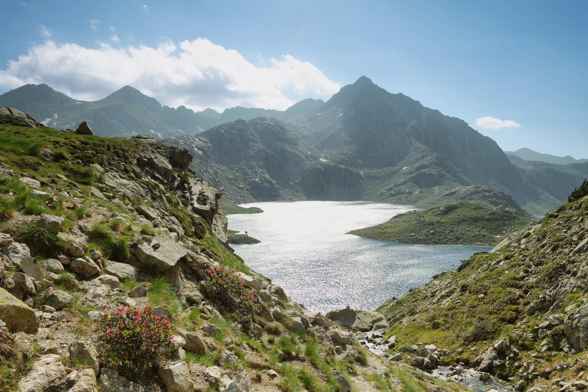
A Pyrenean hut like Colomina is the whole plan in July and August - reserve a bed at least a month ahead
The narrow window when only the Pyrenees are properly usable. Everything below 1,500 m becomes uncomfortable to dangerous — the Meseta on the Camino Francés is walkable only before 9 am, Andalusia is off the cards entirely, and Mallorca is too hot apart from very early morning hours.
This is the season for Carros de Foc, the GR11 and Ordesa. Refugios book out — reserve at least a month ahead in August.
A Pyrenean hut like Colomina is the whole plan in July and August - reserve a bed at least a month ahead
Bracken gone rust on a wet Camino track: October is the best month of the year here, but pack for rain
The country's second working window opens as the summer heat breaks. October is the best single month for a Spanish hiking trip — Andalusia, Mallorca, the coastal Caminos and Picos are all at their most walkable, and the trails carry a fraction of the summer traffic.
Pyrenees high routes hold until mid-September, then close as the first snow lands. By November, only the coastal walks and the deep-south trails are still working.
Bracken gone rust on a wet Camino track: October is the best month of the year here, but pack for rain
What to Watch Out For
The assumption that summer means good conditions gets many hikers into uncomfortable, if not dangerous situations. In Spain, summer can be merciless — dehydration, sunstroke and heat exhaustion account for the majority of trail rescues in Andalusia and along the Camino between June and September.
Three practical corrections handle most of it. Start early: on trail by 6 or 7 am in shoulder seasons, 5 am in June or September on the southern trails. Carry more water than seems reasonable: two litres minimum for any half-day, three for a full day, and know where the next fuente is — Andalusian villages have public fountains marked agua potable, but stretches of the Meseta and rural Norte have nothing between towns. Respect the siesta: from roughly 2 pm to 6 pm, the country stops for a reason, and rural restaurants are closed until 8 pm anyway.
The other detail first-time visitors miss is meal timing. Lunch is between 2 and 4 pm, dinner rarely before 9. If your walking plan finishes at a village restaurant, arrive before 3.30 pm or plan for a snack until dinner service opens.
Setting up Your Trip
Spain's hiking calendar is fragmented enough that planning the trip is often the hardest part. The wrong month in the wrong region turns a holiday into an ordeal, and one-way point-to-point routes need either two rental cars or a stack of local logistics. If you would rather not do that yourself, our self-guided walking trips across Spain come with the whole planning stack handled:
Every night's accommodation booked in advance for your dates
Baggage transfers between stages, so you walk with a day pack only
Detailed digital guidebook with maps, GPS files and route notes
On-trip support in English by phone or WhatsApp
For the full range of options, see all our Spain hiking tours. If you're considering the French side of the range too, our Pyrenees destination guide covers it, and for pilgrim routes further south, our Portugal walking holidays include the southern Camino Portugués stretches.

About this author
Ajda is our travel advisor, raised in a village surrounded by mountain peaks. Hiking entered her life early on and remains her favorite way to reconnect with nature.











.jpg&w=828&q=75)