Hiking in Cappadocia: The Ultimate Guide
The land most known for hot air balloon rides is also one of the most memorable hiking destinations in Turkey. Here is how to plan walking there.

Ajda
Published September 22, 2026
Edited September 22, 2026
18 min read
Quick links
Cappadocia sits in the middle of Turkey, on a high plateau in central Anatolia where an ancient volcano buried the land in ash that hardened, then wore away into pillars, cones and ravines.
It is best known for its spectacular rock formations — the cones and chimneys that fill every photograph of the place, usually with a few dozen hot air balloons floating over them at dawn. What gets mentioned less often is that those same formations are threaded with footpaths, and that walking in among them beats looking down on them from a basket. Few people arrive thinking of this as a hiking destination, but the valleys make a strong case for it.
Those who do go there for hiking, arrive in Göreme with a list of valley names taken from a photograph: Love, Rose, Red, Pigeon, Devrent. But some are half-day walks on decent paths, one is a short ticketed loop, another one is a car park with a view. Sorting them out is most of the planning.
Hiking in Cappadocia means short, low-altitude valley walks — an hour or three each — linking cave churches, rock towers and old troglodyte villages, on ground almost anyone can manage. The skill you need the most is navigation, because the trails fork, double back and occasionally dead-end. Get that part right and it is one of the most spectacular places anywhere to walk.
What Hiking in Cappadocia Is Like
Let's start with the fact that may be the helpful to lovers of continuous, long-distance routes. Turkey has the Culture Routes Society, a body that builds and paints long-distance footpaths — and none of them run through Cappadocia.
There is no such thing as a long, structured Cappadocia trail. What there is instead is a dense network of paths threading the valleys between Göreme, Uçhisar, Çavuşin and Ürgüp, worn in by farmers, pigeon keepers and a century of visitors, braiding and rejoining and occasionally stopping at a cliff.
Cappadocia trekking is plateau walking, not mountain walking, and the valleys are shallow, mostly under 100 m deep. The rock is volcanic tuff, soft enough to dig by hand. That softness is another reason why walking is easy.
At a Glance: the main valleys
Valley | Rough distance | Effort | Why walk it |
|---|---|---|---|
Rose & Red | 6–11 km combined | Easy | The signature sunset walk, past cave churches cut into pink rock |
Pigeon | 4–5 km | Easy | Uçhisar to Göreme, dovecotes carved high in the cliffs |
Love | 3–4 km | Easy | The tallest, most photographed fairy chimneys |
Zemi | 5–6 km | Easy–moderate | Shaded, greener, quieter than the rest |
Meskendir | 4–5 km | Easy | Tunnels and a stream, links neatly into Red Valley |
Paşabağ (Monks Valley) | 1–2 km | Very easy | Twin- and triple-capped chimneys, short and close to the road |
Those figures are the valley floors themselves. A walking day links two or more of them plus the climb in and out, which is why the days below run longer.
The Best Hikes in Cappadocia - With Map
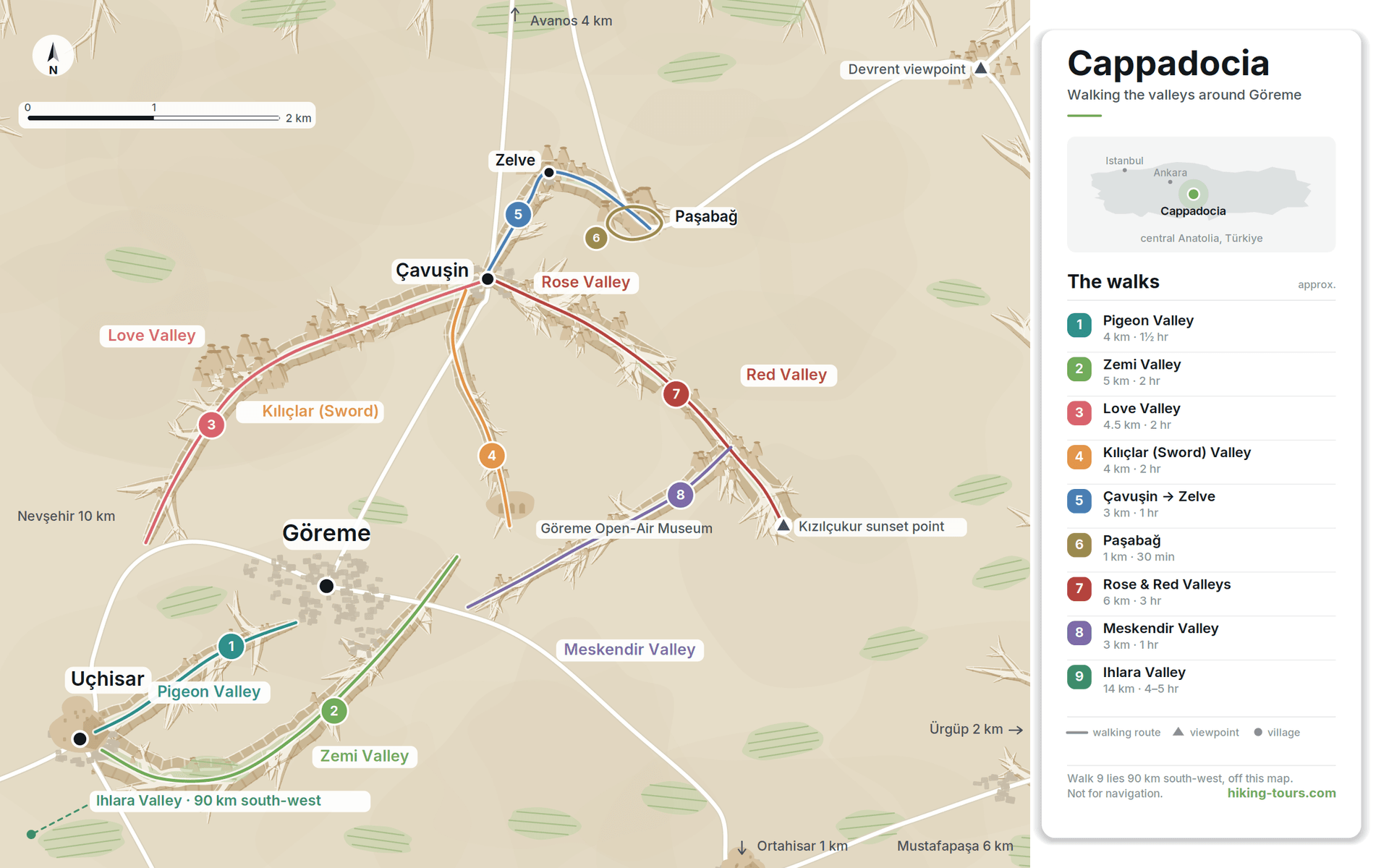
Cappadocia's valleys are not all walkable, and the names give you no clue which are. Some hold a comfortable half day on a real path, some hold twenty minutes behind a ticket gate, and at least one is a pull-in on a road. In general, each Cappadocia valley falls into one of three categories: some carry a half day of walking, some carry twenty minutes, and at least one has no path running through it.
Here is what each of the famous valleys in the region actually gives you.
Zemi Valley
Everything around Göreme is dust and bare rock. When you drop into the Zemi, there are trees over the path. A small stream runs the length of the valley floor, crossing the trail half a dozen times, and it feeds poplars, orchards and enough leaf cover that you walk much of it in shade — the reason to pick this one in summer, when the other valleys offer none at all.
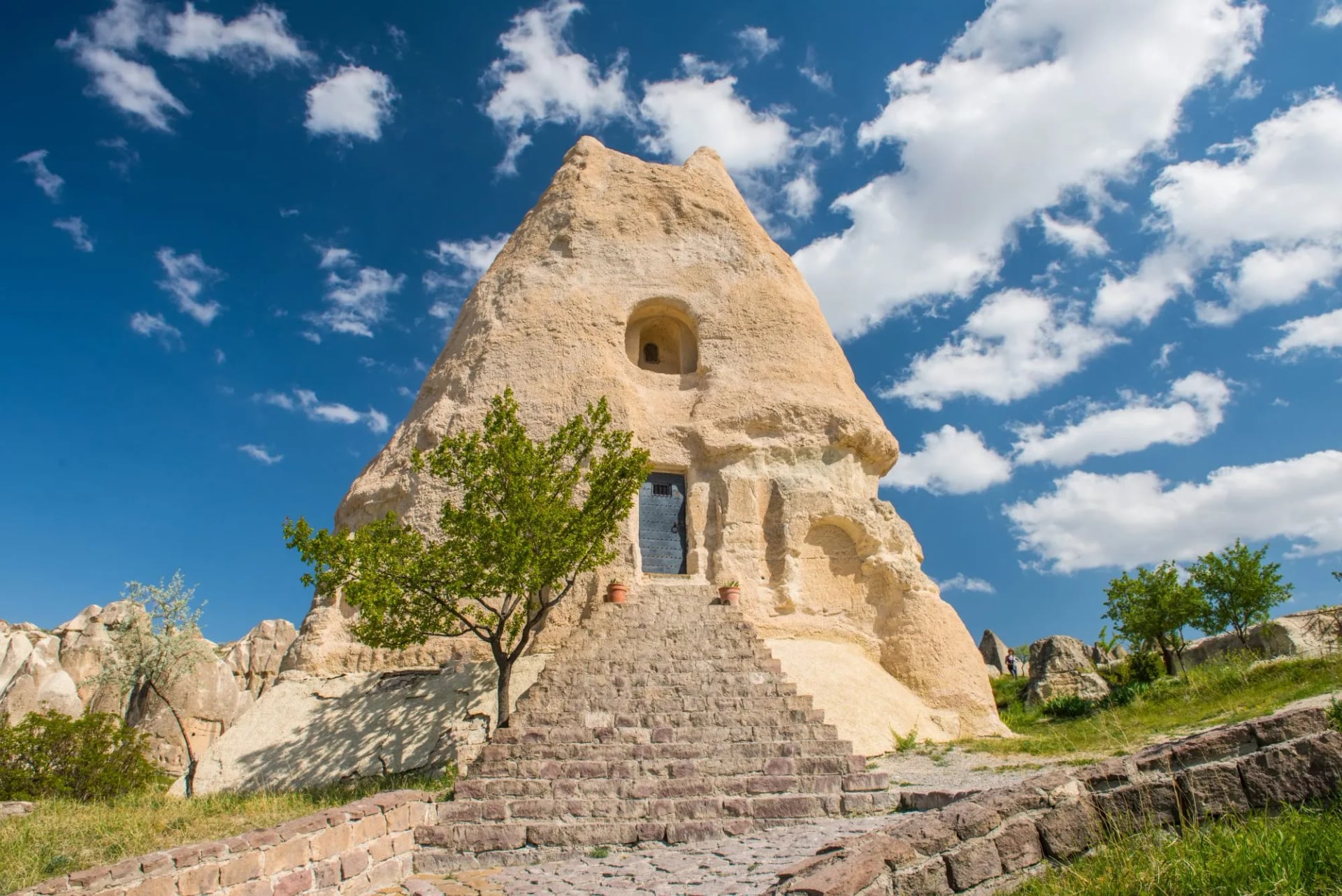
Then, standing out in the open on the valley floor, there is a single cone of volcanic rock with a doorway cut into its side. This is El Nazar, a Byzantine church a thousand years old, and the Nativity, the Crucifixion and the Ascension are still on its walls in red and ochre. No ticket desk, no queue, no glass: you duck through the door and you are standing inside it.
It offers 5-6 km of path, and the gentlest walking in Cappadocia.
Rose and Red Valleys
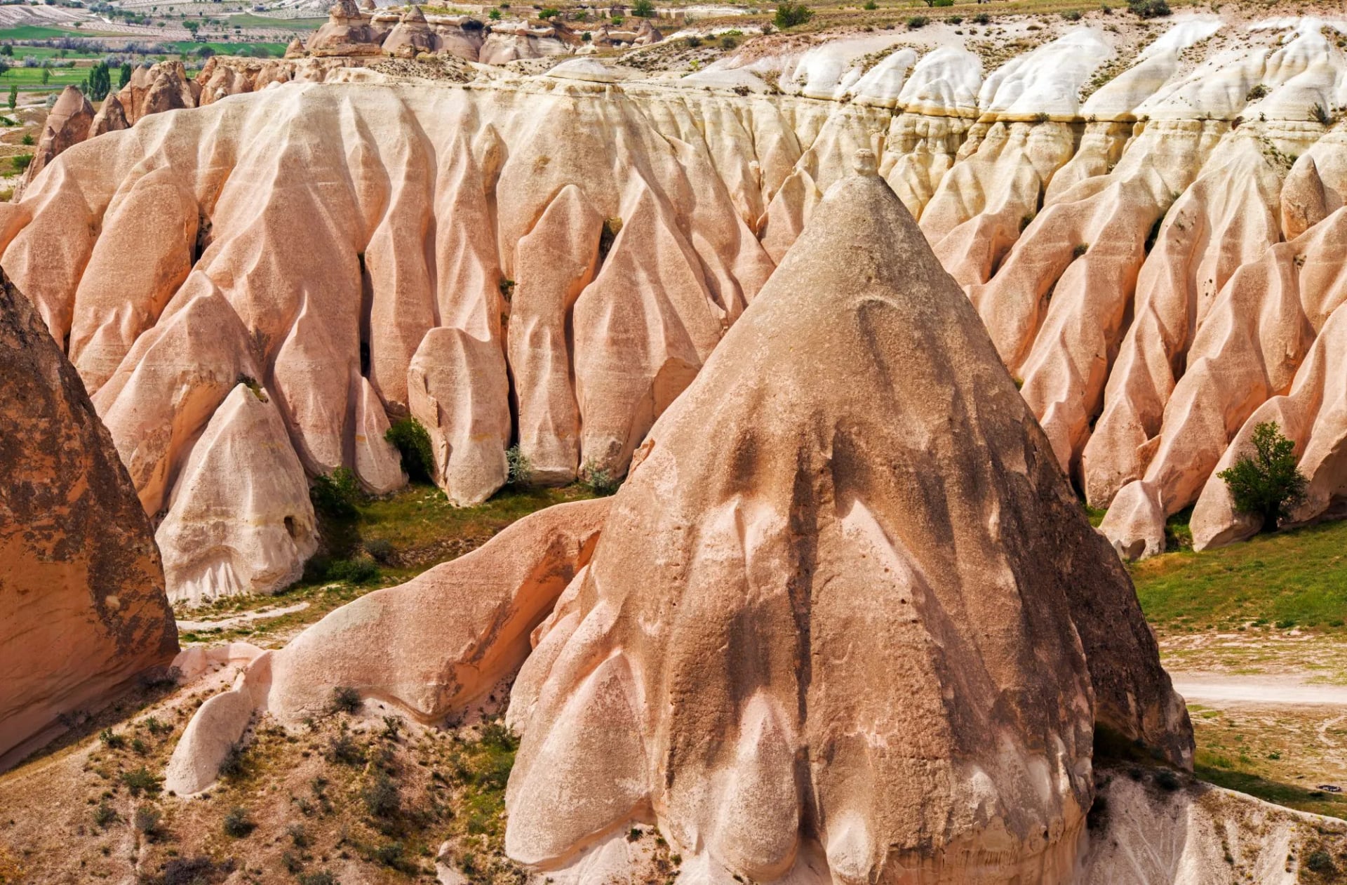
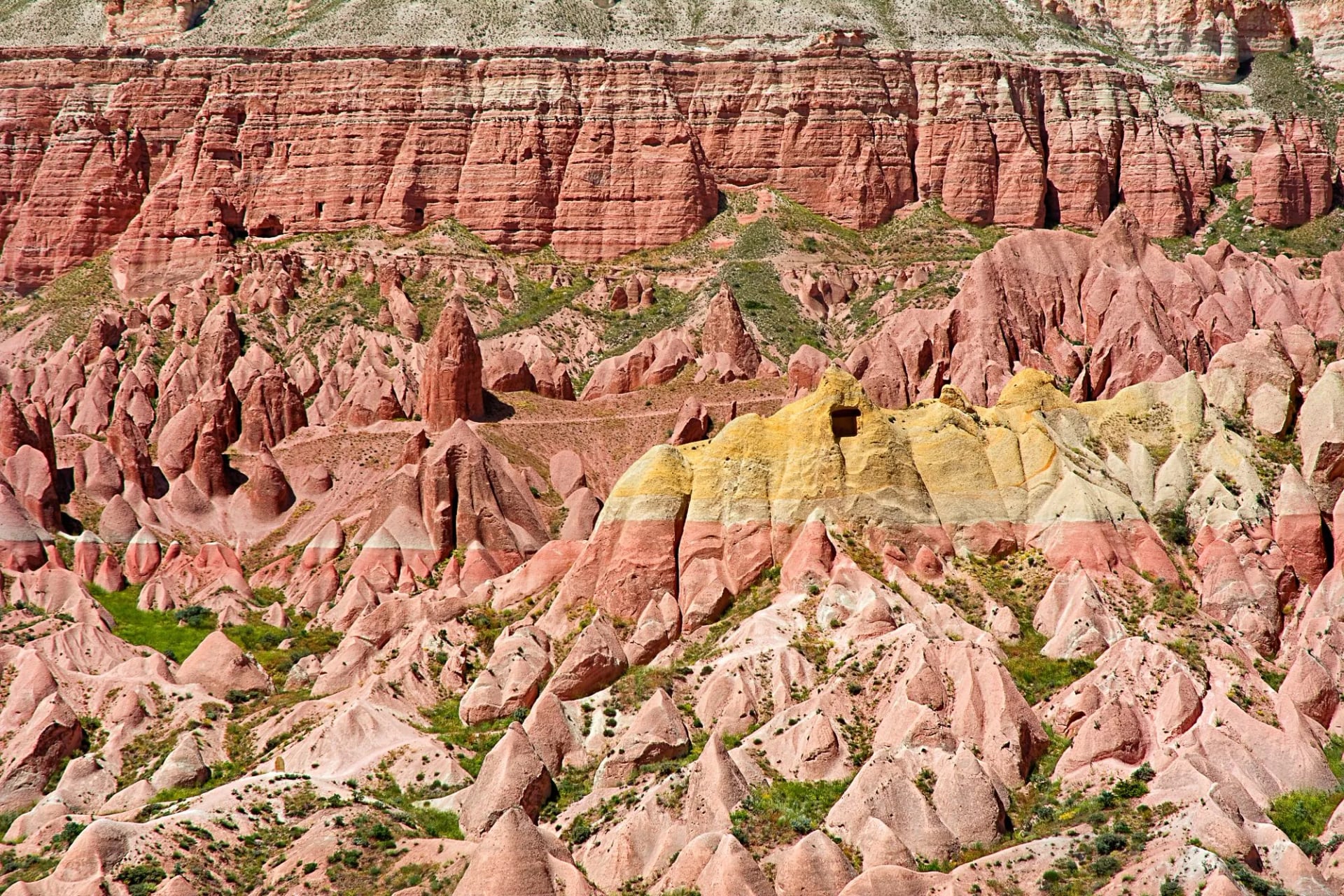
Rose and Red are the valleys people come to see for the color, and you see why at the first bend: whole cliffs banded in pink, rust and ochre with pale yellow seams cutting across them, and slopes of pointed cones stacked up below. That's there at any hour of the day. Low evening sun deepens it — in the last hour the pinks turn to fire and the yellow bands glow, which is why half of Göreme walks out to the Red Gorge rim in the evening. Rose is the paler one, rounder, with smooth banded domes. Red — Kızılçukur on Turkish maps — is harsher, banded in pink, rust and yellow.
They adjoin, so one loop takes in both, 6 to 11 km depending how you link them, with cave churches cut into the rock along the way and the Kolonlu church among them. Work out your way back before the light goes, though, because the paths braid badly and everything looks identical in the dark.
Love Valley
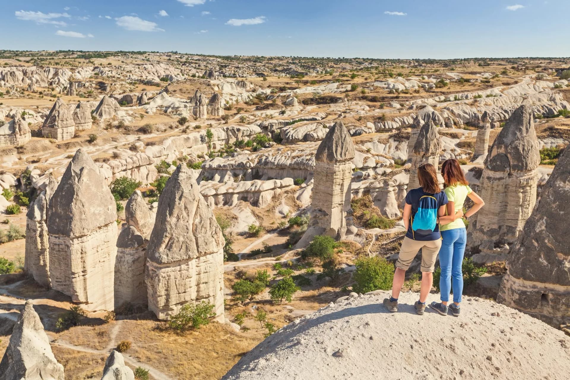
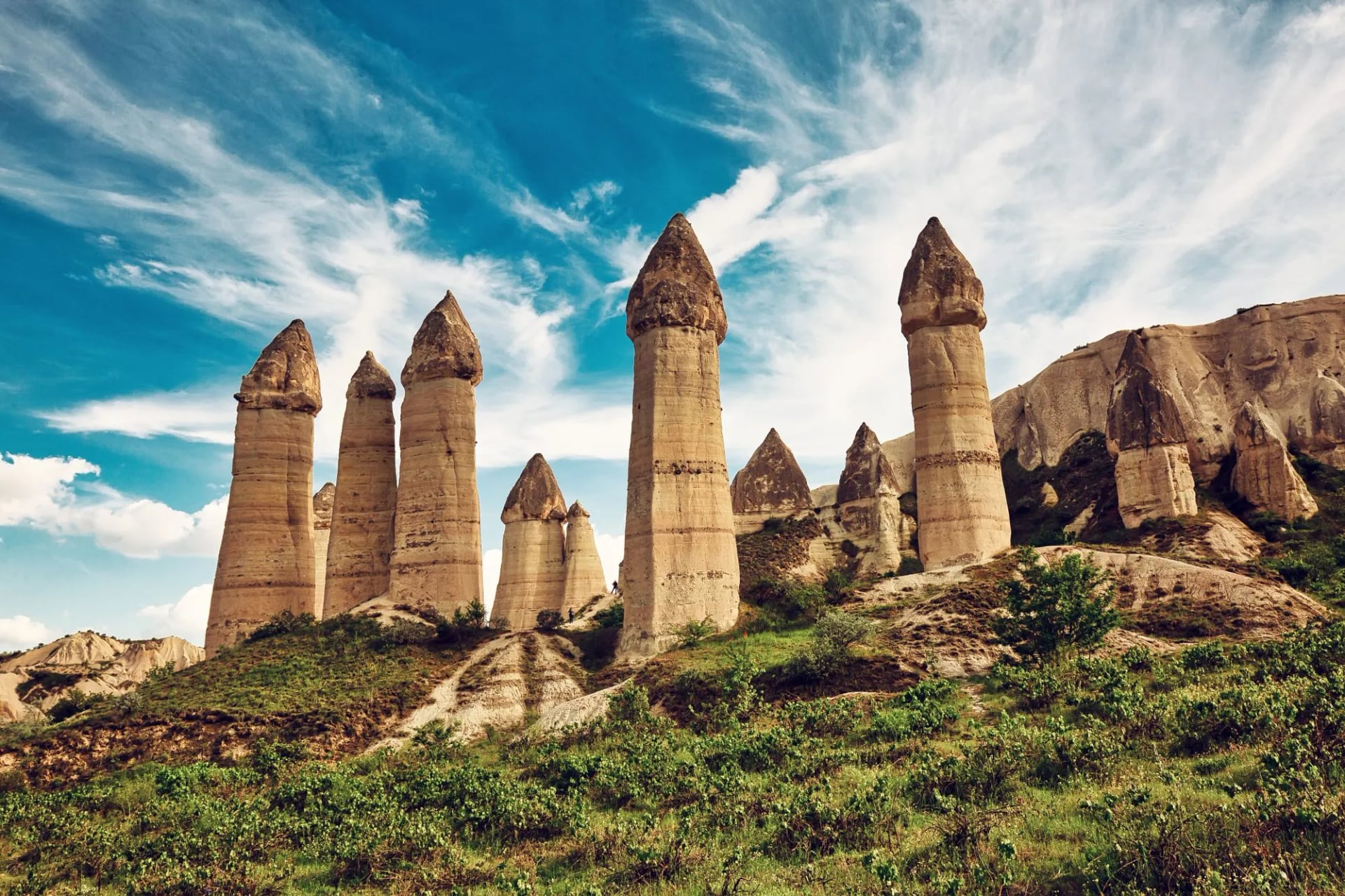
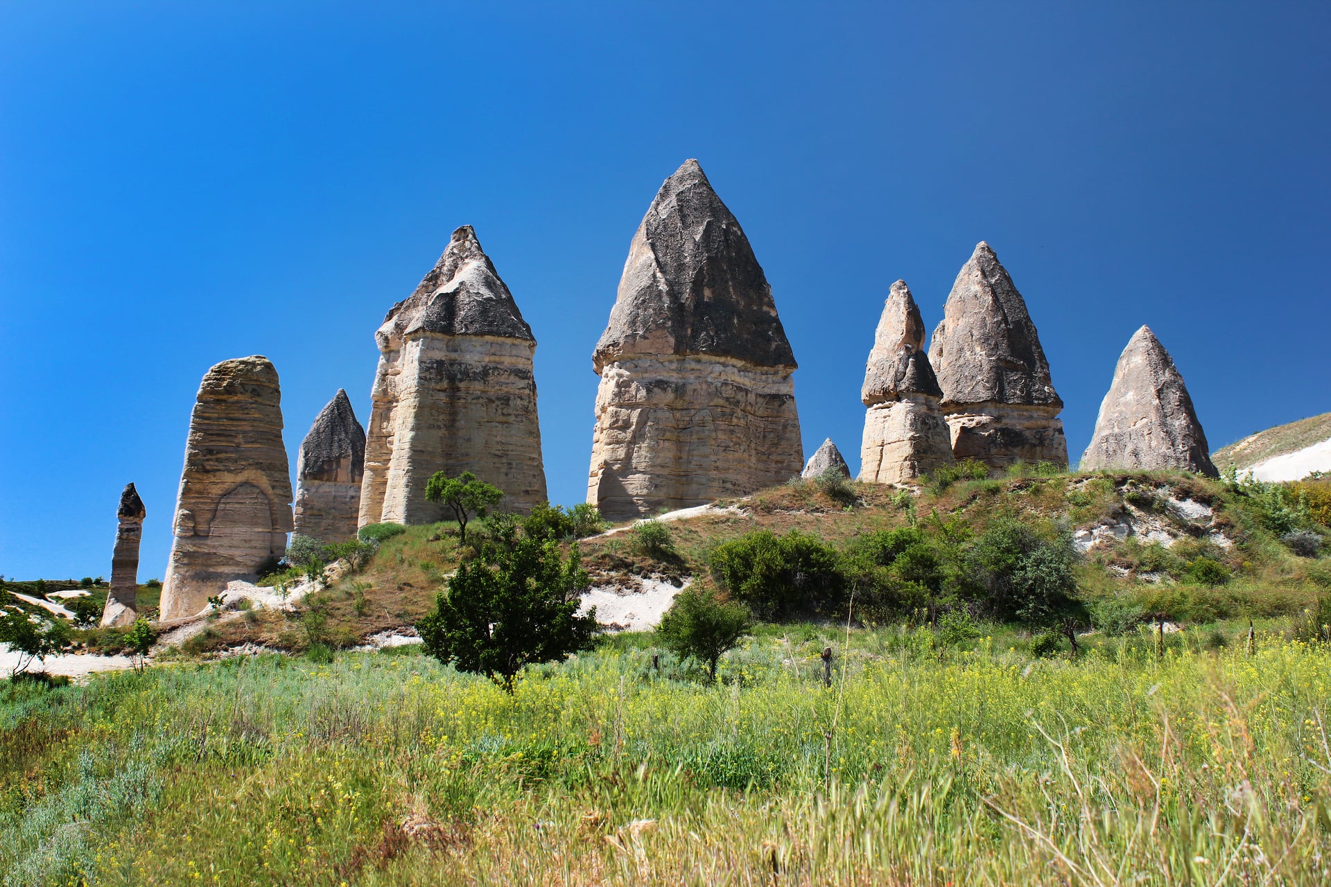
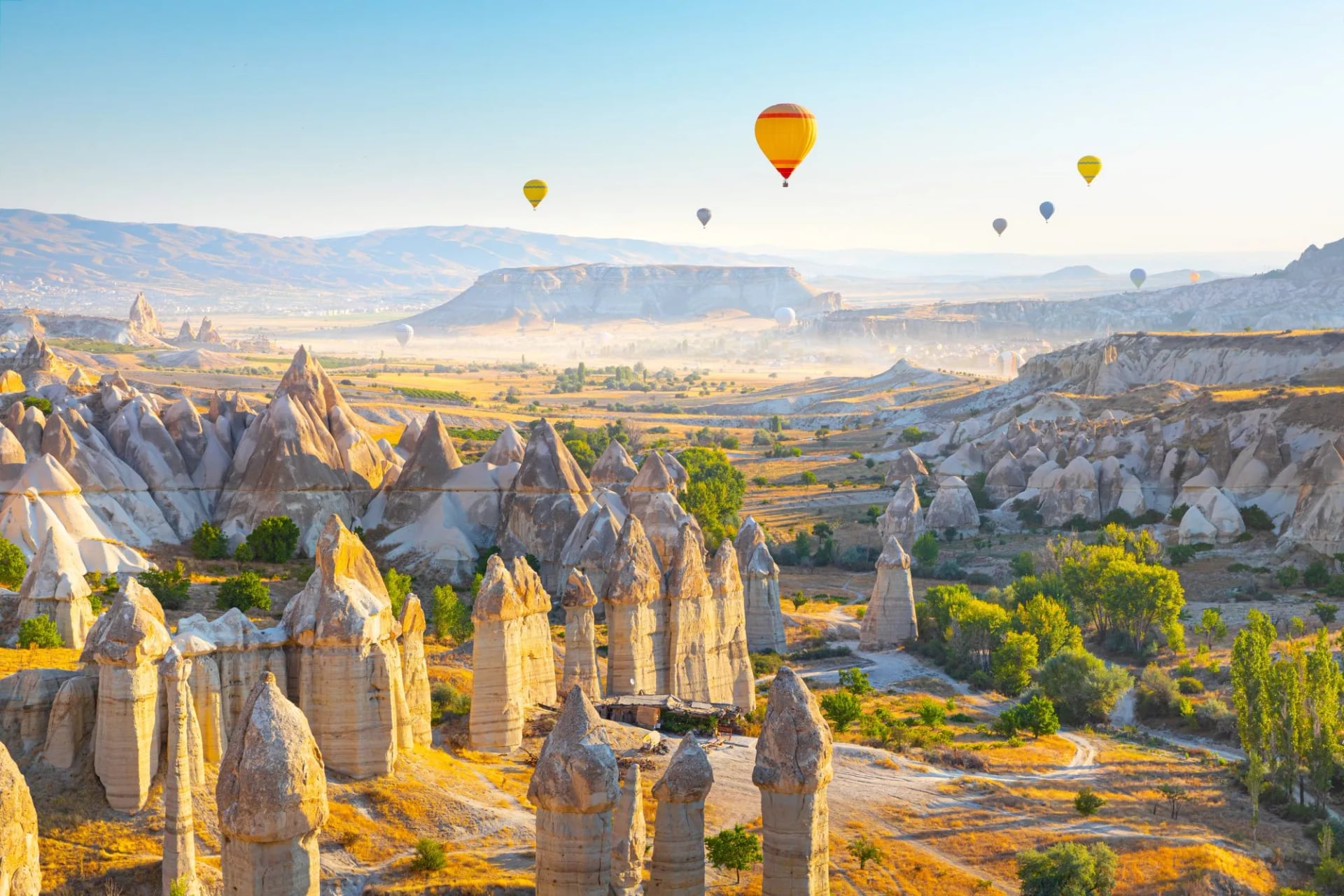
The columns in Love Valley stand up to 40 meters — a twelve-story building — and they stand in a crowd. Everywhere else in Cappadocia the fairy chimneys are squat cones; here they are tall, straight pillars with dark caps balanced on pale stems, and the track runs right between them, so you walk through the middle of the group rather than looking at it from a viewpoint.
This is the formation on every postcard of Turkey and it takes an hour to walk, 3 to 4 km, longer if you keep stopping. Link it with Pigeon Valley and you have a pleasant, explorative morning walk.
Pigeon Valley
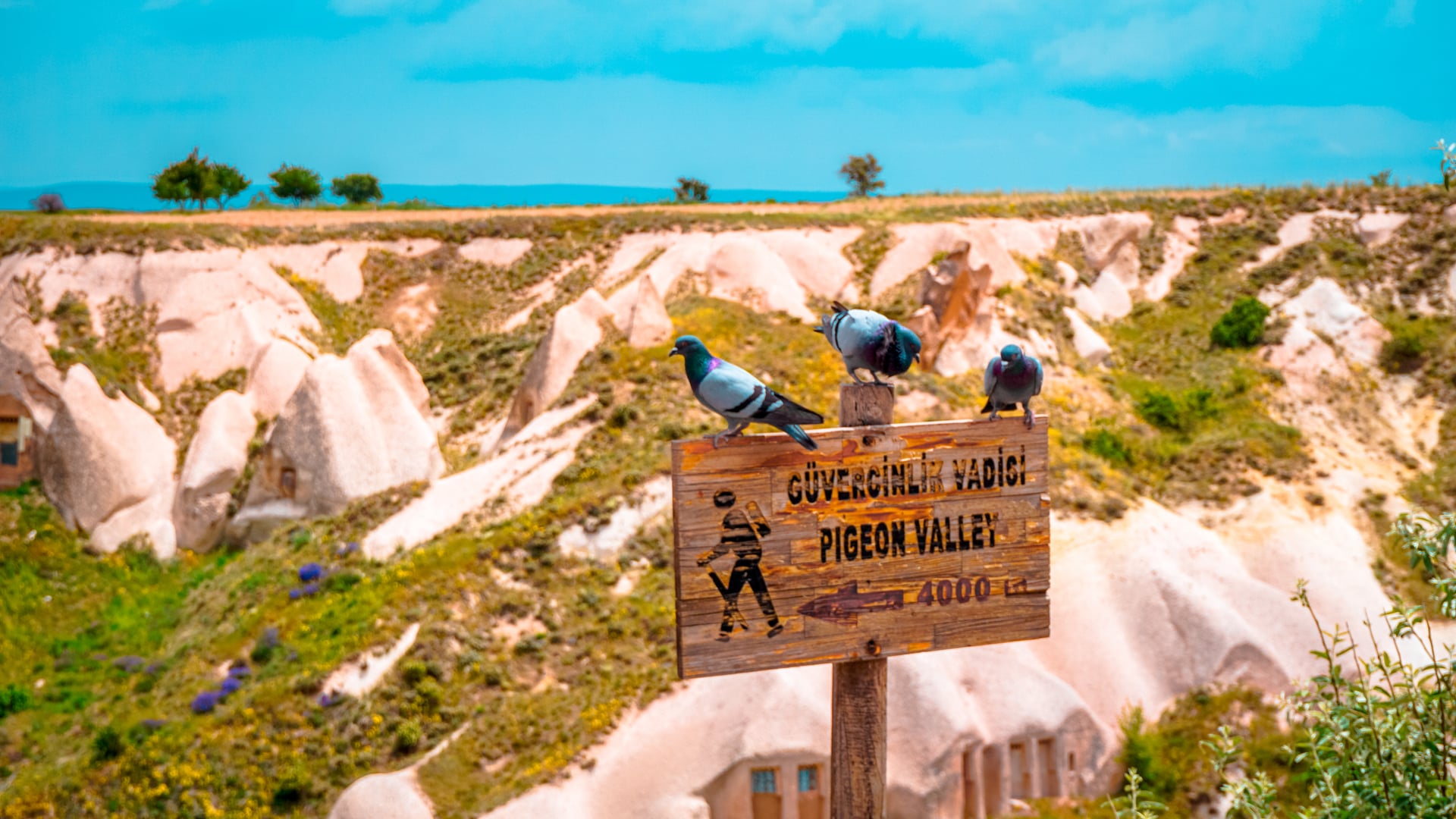
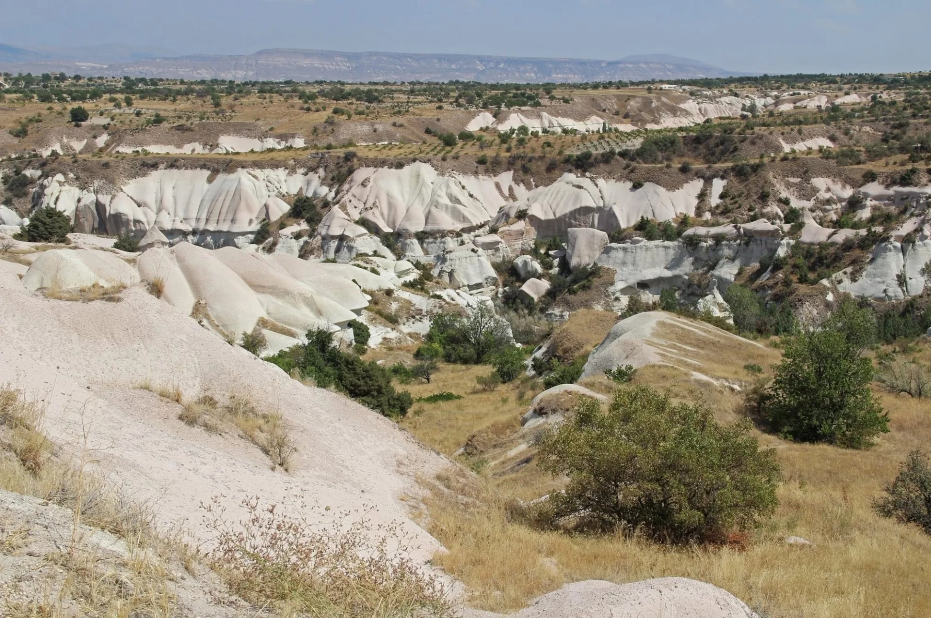
Look up in Pigeon Valley and see that the cliffs are perforated — thousands upon thousands of small openings, every one of them cut by hand. They are dovecotes, chipped out over centuries by farmers who wanted the droppings to feed their vineyards, and once you know that the whole valley reads differently: this is a working agricultural landscape, not a fortress.
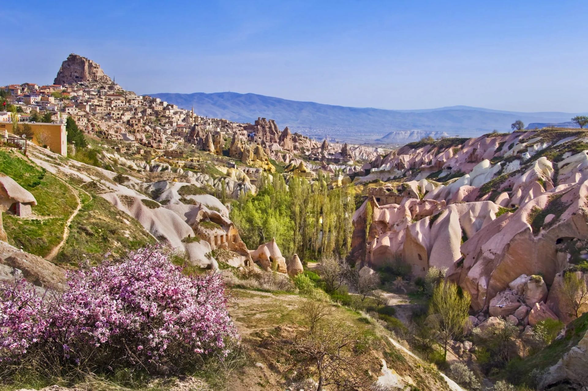
The path runs 4 to 5 km between Göreme and Uçhisar, and if you walk it uphill it finishes you on Uçhisar itself, an entire outcrop of rock hollowed into rooms and tunnels, rising over the plateau like a termite mound. Go late in the day.
Paşabağ
In Paşabağ, the cones eroded differently from the rest of Cappadocia — their caps split into two and three separate heads, which is why these particular mushrooms end up on most photographs of the region. A narrow staircase climbs up inside one of them to the chapel of Saint Simeon, where hermit monks cut a cell and a prayer niche into the rock; you can stand in it.
It's a gated site on a ticket shared with Zelve, and 20-40 minutes covers the loop and the climb.
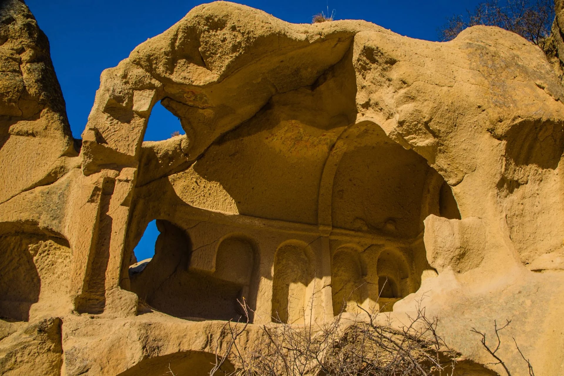
Meskendir Valley
In Meskendir, the path goes through the rock rather than around it, ducking into short tunnels cut in the tuff and back out into the light, with a stream running along the bottom.
It is only 4 to 5 km, and it joins Red Valley at its top end, which is how most people take it — the first half of a longer afternoon rather than a trip of its own.
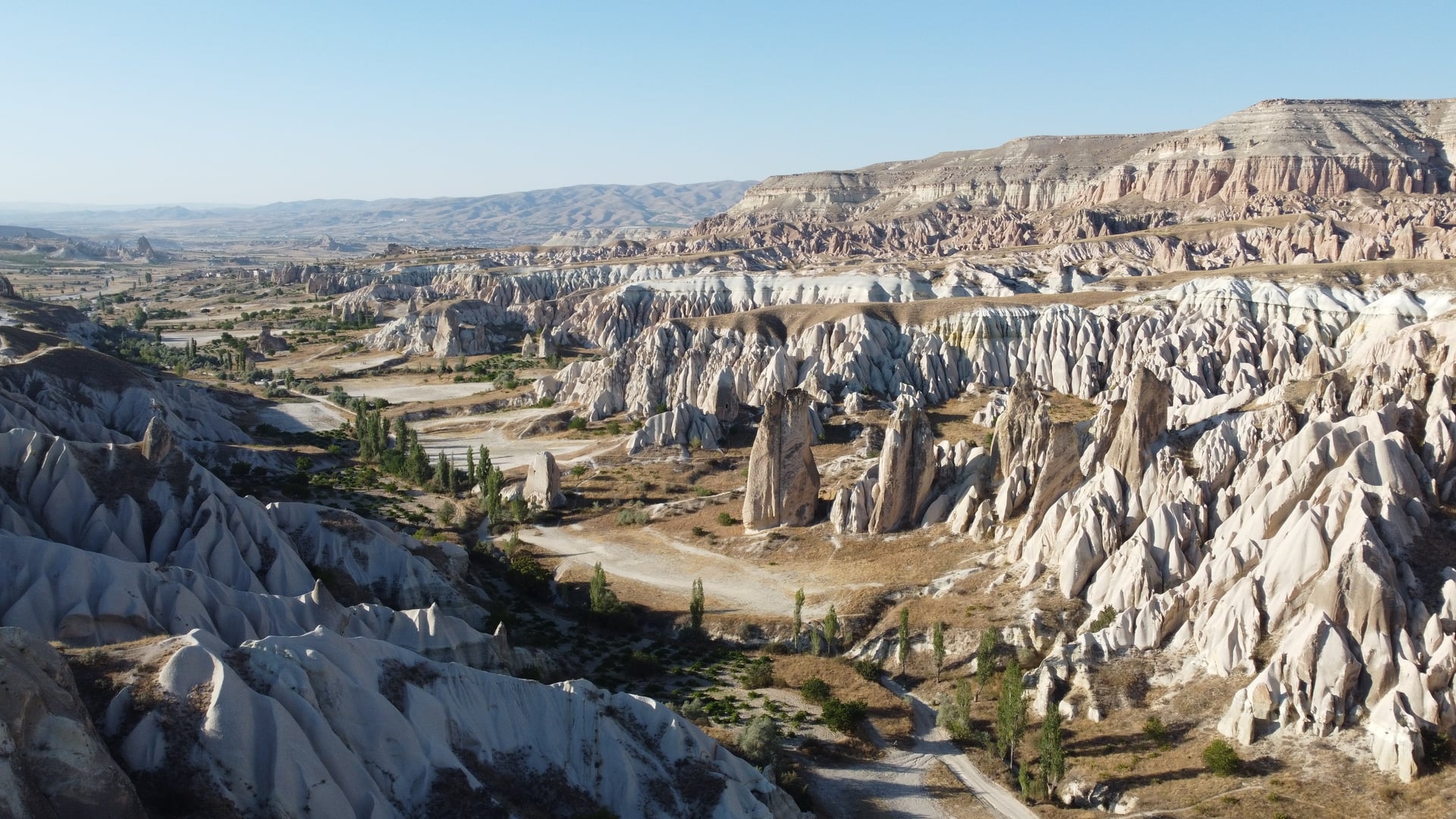
Kılıçlar, the Sword Valley
Kılıçlar begins 150 meters from the edge of Göreme and almost nobody walks it. You move through slots barely wider than your shoulders, past the blade-like rocks the valley is named for, and at one point into a tunnel 300 meters long. Kılıçlar Church, cut into the wall along the way, still holds frescoes of 33 biblical scenes.
It is 2.5 km and takes an hour or two, and of all the walks around Göreme this is the one that feels like exploring. The path carries on into Meskendir and toward Çavuşin if you want to keep going.
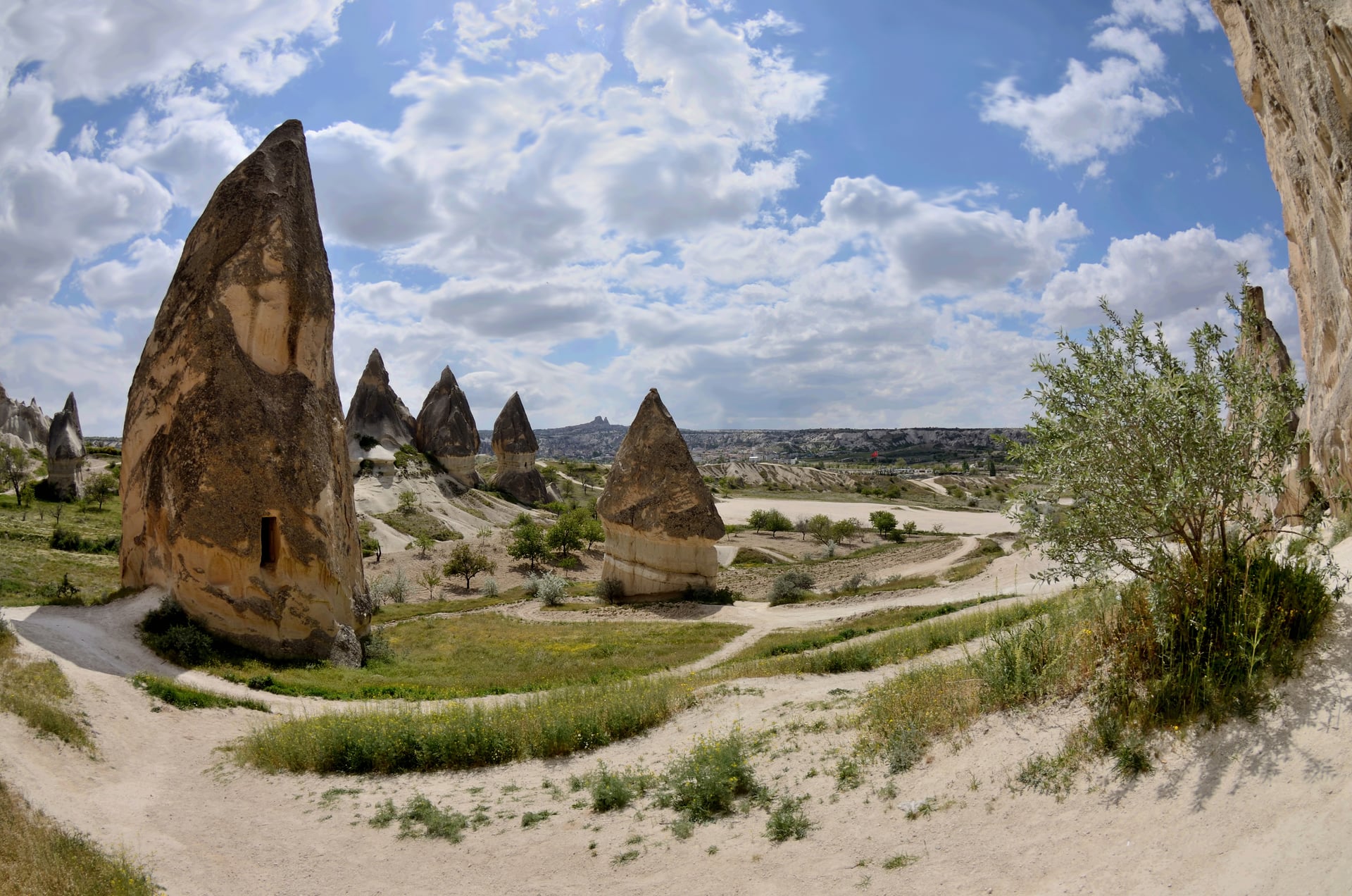
Çavuşin
The cliff above Çavuşin is riddled with rooms — an entire village's worth, cut into the rock face and standing empty. People lived in them into living memory, and you can still see doorways, niches and soot on the ceilings. Above it all sits the Church of St. John the Baptist, one of the largest rock-cut basilicas in Cappadocia. You can walk here from Göreme on the valley paths instead of driving, which is the way to arrive.
The approach is exposed and the stonework is fragile, so treat the old village as a ruin rather than a site: parts of the cliff have come away. Paşabağ, with its two- and three-headed cones, makes a short detour on the way in.
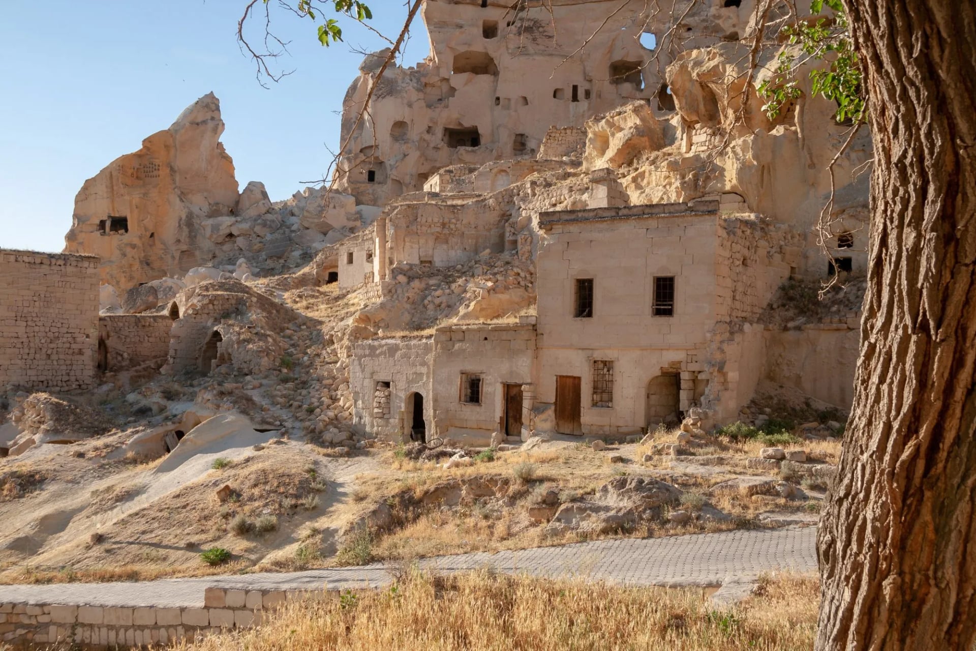
Outside Göreme: Ihlara Valley
Four hundred steps take you off a bare, dry plateau and down into Ihlara, and the temperature drops as you descend. At the bottom there is a river, poplars, birdsong and shade, walls rising 150 meters on either side, and something like fifty churches cut into those walls over 15 km of gorge. Nothing around Göreme is remotely like it.
The catch is the distance: Ihlara sits roughly 100 km west, an hour and a half by road and in another province, so it needs a car or a day tour and it will take the whole day. The walkable stretch runs from Ihlara village to Selime.
Ihlara Valley Is Not a Göreme Walk
This is the correction that saves the most wasted planning. Ihlara appears on nearly every list of Cappadocia hikes and it is a genuinely good walk. But it sits in Aksaray province, outside the World Heritage boundary, which runs between Nevşehir, Ürgüp and Avanos.
What it is, is a gorge: around 15 km long and up to roughly 150 m deep, cut by the Melendiz river through tuff laid down by Hasan Dağ. Something like fifty rock-hewn churches line its walls, on a walkable section from Ihlara village to Selime.
The valleys around Göreme are shallow and open; this is a slot with a river in it, entered down a stairway of nearly 400 steps. It needs a car or a day tour, so budget a whole day for Ihlara or leave it out. Our Turkey page is the place to raise it.
A Museum You Can Walk Through
The reason to come hike in Cappadocia is not the elevation profile — it is what you walk past. This whole region was designated a UNESCO World Heritage Site in 1985 as Göreme National Park and the Rock Sites of Cappadocia, and the citation is not decoration. Over 200 rock-cut churches are hidden in these valleys, many still holding Byzantine frescoes from the tenth to thirteenth centuries, alongside monastic cells, dovecotes and whole underground cities where early Christians sheltered. You do not queue to see this behind glass. You step off the path, duck through a low doorway, and you are standing inside it.
That is what sets Cappadocia apart from an alpine trek, where the payoff waits at a summit or a col. Here the reward is spread along the whole walk, and it is cultural as much as scenic. The fairy chimneys rise up to 40 m — soft volcanic tuff that wind and water have whittled into towers, some capped with a harder boulder like a stone hat. When people say hiking in Cappadocia feels like walking through a film set, this is what they mean, and for once the cliché undersells it.
What a Walking Day Here Actually Asks
Most write-ups of this region are lists of day loops, which leaves the obvious question unanswered: what does a full week here actually add up to?
Four walking days run 9 km through Zemi, 11.5 km through Rose and Red, 15.5 km through Love and Pigeon, and 8 km to Çavuşin. Ascents of 270 m, 370 m, 450 m and 200 m mean the whole week climbs 1,290 m across 44 km.
Put that beside our western Lycian week, which takes 3,540 m of ascent in five days. Cappadocia asks roughly a third as much climbing, which is the reason the two weeks suit different people.
The grading follows. The week is fitness level 1 and technical level 1 on our five-point scales, which the difficulty guide defines as suitable for anyone who enjoys an occasional hike, on easy trails without steep or rough sections.
Look at day four before assuming the whole week is a stroll. Day four is nearly twice the first, and it arrives when your legs have already done two. Nobody expects the hard day to be the one through the postcard valley.
The structural difference from a normal walking holiday is bigger than the numbers. This is a center-based week, five nights in one hotel in Göreme, walking out and back each day. There are no luggage transfers because there is nothing to transfer.
That has a real consequence for the walking. Because every day returns to the same base, you are never committed: a day that turns out too hot or too long can be cut short onto a road, and roads are rarely more than a couple of kilometers away. You can always shorten a day here.
When to Go
The universal advice for Cappadocia is spring or autumn, and it is half wrong. The Turkish State Meteorological Service’s long-run normals for Nevşehir do not support treating the two shoulders as equivalent.
May is the wettest month of the whole year here, at 57.9 mm across nearly 13 days with rain. April is barely drier at 50.2 mm over twelve and a half. Spring gives you flowers, green valley floors and blossom in Pigeon Valley, and a one-in-two chance of rain on any given day. That is a trade rather than a warning: the rain here tends to come in short bursts rather than all-day fronts, and it is what makes the valley floors green.
Autumn does the opposite. October takes 28.0 mm across 7 wet days at an average maximum of 18.3 °C, close to ideal for a long day on open ground. Locals seem to agree: the region's ultra-distance race, roughly 119 km with about 3,730 m of climb, is run from Ürgüp in mid-October.
Summer rules itself out for a different reason than you would guess. July and August are almost rainless, at 9.4 mm and 8.4 mm, with average maxima of 28.5 °C and 28.7 °C, which sounds manageable. The problem is shade, not heat, and the valleys have almost none once the sun is up.
Winter is the one people underestimate. January averages a minimum of -3.6 °C against a maximum of 4.0 °C, and snow on the fairy chimneys is a common photograph rather than a rare one. The valleys are walkable in it, but the days are short and the tuff gets slick.
Balloons and the Walking Day
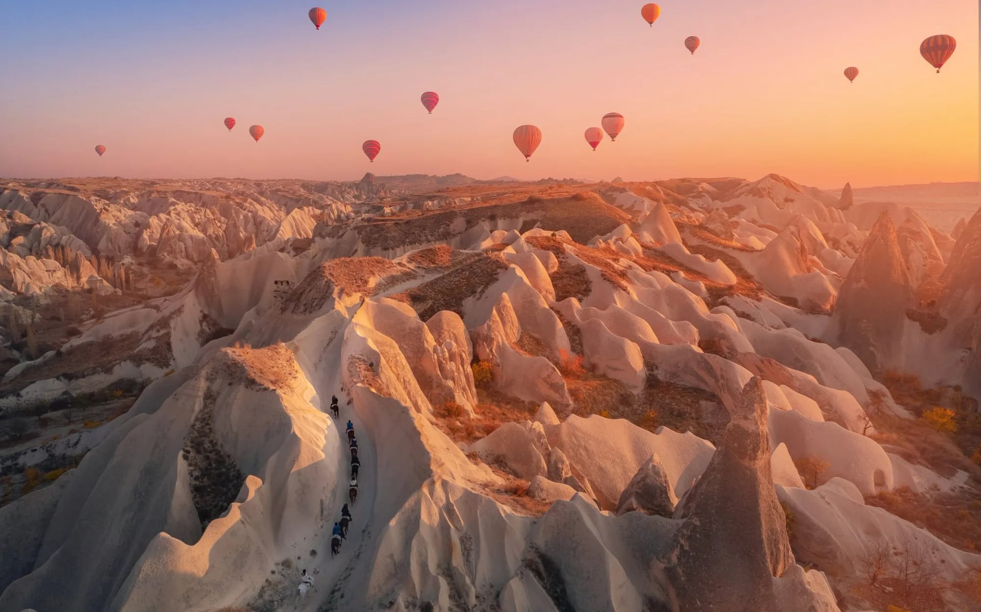
Balloons are not a distraction from the walking here, they are a scheduling constraint on it. Flights go up at first light and only in the morning, and they are cancelled outright for wind, poor visibility or rain. Balloons overhead means walking before sunrise.
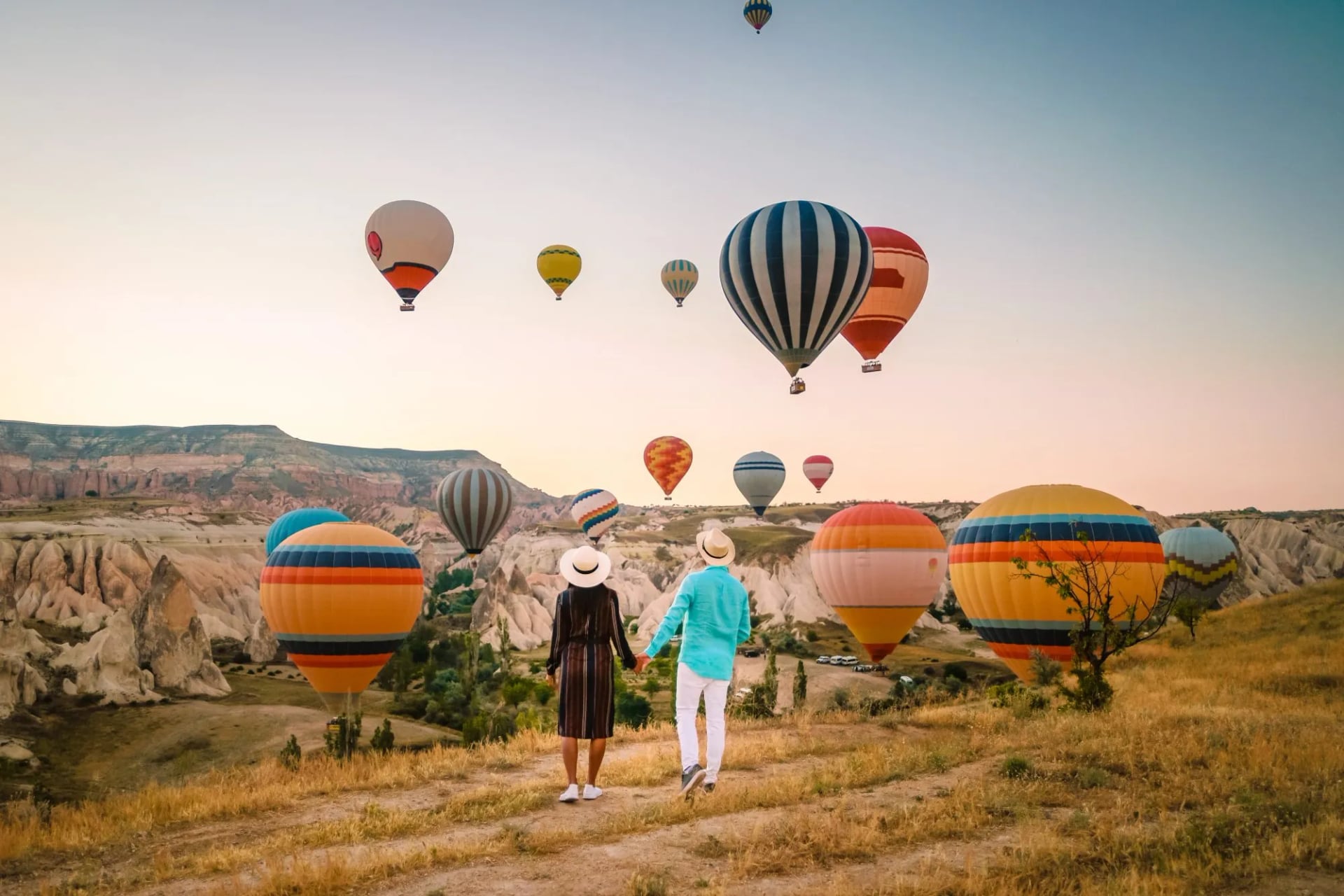
The rim above Rose and Red Valleys and the open ground below Uçhisar are where the balloons pass low enough to matter, and being there for it means a pre-dawn start followed by a full walking day.
The alternative is to take the evening instead. Nothing flies at sunset, so the valleys are yours, and low sun does more for the rock color going down than coming up. Rose and Red are the pair to save for it.
Whichever you choose, keep the two apart. A pre-dawn balloon morning is not a walking morning, and stacking them is how people end up doing neither properly.
Know Before You Arrive
Carry cash, and more than a European city break would need. Card payment is normal in Göreme itself, but the tea stands along the valley paths, the village shops and the smaller gate huts often take notes only. Draw money in Göreme rather than expecting a machine on the way.
Know which ground is gated and which is open. The Göreme Open Air Museum, Zelve and Paşabağ each sit behind a ticket gate with fixed hours, and the Dark Church inside the Göreme complex is charged separately again.
The valleys themselves, including Love, Pigeon, Rose and Red, are open ground you walk into. Gate arrangements here change without notice, so check on arrival rather than planning around last year's advice.
Water is the constraint nobody plans for. Göreme sits on a plateau near 1,000 m with almost no shade in the valleys, and there is no drinkable source on any of these walks. Two litres a person is a minimum, not a precaution.
Navigation is the real difficulty here. With no waymarking and a braided path network, the standard failure is not getting badly lost but ending up in a dead-end side valley below a cliff and walking back. Download offline maps, keep the plateau rim in view as your reference, and treat any path that starts descending steeply as suspect.
Two local hazards are worth knowing about. Stray dogs are common and can move in packs on open land, and the advice is not to approach them. Wildfires are frequent in summer, and starting one in Turkey carries fines or imprisonment.
Footwear matters more than the easy grading suggests. Tuff weathers to a fine dust that behaves like dry sand on any slope, and the paths cross rockfall and dry watercourses. Trail shoes with real grip beat walking sandals here.
Kayseri and Nevşehir both have airports within reach of Göreme, and 112 is the single emergency number for ambulance, fire and police. Signal in the valleys is patchy but rarely absent, because you are never far from a village.
Our Cappadocia Walking Week
We have one Cappadocia trip and it is self-guided: route notes, GPS tracks and support through the week, without a group schedule. How that works is set out in self-guided tours explained.
Said plainly, this is the gentlest walking week we publish and deliberately so. Four short days from one hotel is the whole design, and the free afternoons are the point rather than a gap.
Cappadocia Trails
Distance: 44.0 km across four walking days
Ascent: 200 m to 450 m a day
Sleeping: five nights in one hotel in Göreme, no transfers
Grade: fitness 1 of 5, technical 1 of 5
Zemi, Rose, Meskendir, Love, Pigeon and Paşabağ across four walking days, with Uçhisar Castle, El Nazar and the Church of St. John the Baptist on the route rather than beside it. Six valleys in under a week, on paths a first-timer would take days to work out alone.
Only day four needs respect, at 15.5 km and 450 m, and it can be cut short onto a road at several points if the heat wins.

About this author
Ajda is our travel advisor, raised in a village surrounded by mountain peaks. Hiking entered her life early on and remains her favorite way to reconnect with nature.















































.jpg&w=828&q=75)





















